Garmin G1000 Pilot’s Guide for the Diamond DA42NG
190-00-00962-04 Rev. A
446
HAZARD AVOIDANCE
SYSTEM
OVERVIEW
FLIGHT
INSTRUMENTS
EIS
AUDIO PANEL
& CNS
FLIGHT
MANAGEMENT
HAZARD
AVOIDANCE
AFCS
ADDITIONAL
FEATURES
APPENDICESINDEX
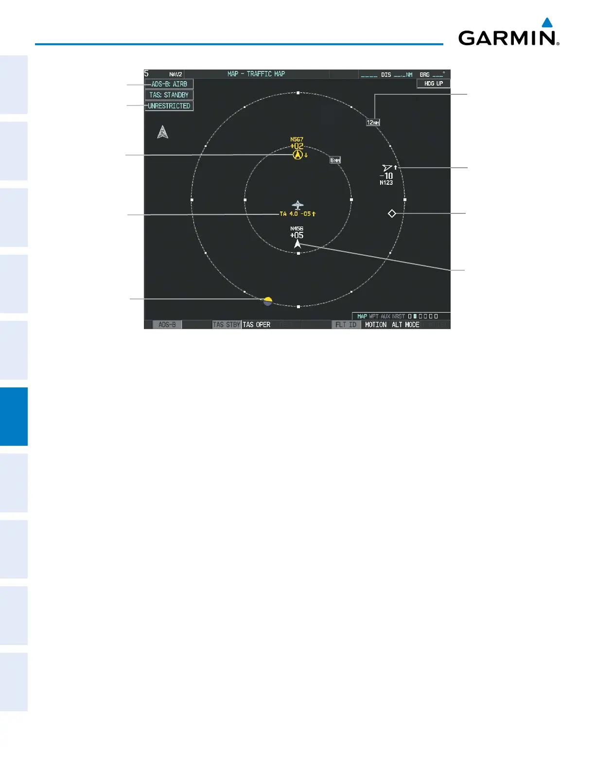
Figure 6-195 Traffic Map Page
Airborne
Application On
Altitude
Mode
Non-Threat
Traffic with
Directional
Information
10000’ Below,
Climbing
Off-Scale Traffic
Advisory
“No Bearing”
Traffic (Bearing
Undetermined),
Distance 4.0
nm, 500’ Below,
Climbing
Traffic Display
Range
Traffic Advisory
with Directional
Information
200’ Above,
Descending
Non-Threat
Traffic,
Altitude Not
Reported
Proximity
Advisory with
Directional
Information,
500’ Above,
Level
Enabling/disabling the display of ADS-B traffic.
1) Select the Traffic Map Page.
2) Press the ADS-B Softkey.
Or:
a) Press the MENU Key and turn the small FMS Knob to highlight ‘ADS-B On’ or ‘ADS-B Off’.
b) Press the ENT Key.
Testing the display of ADS-B traffic:
1) Select the Traffic Map Page.
2) If necessary, turn the Joystick to select a map range of 2 and 6 nm to ensure full test pattern display.
2) Ensure the ADS-B Softkey is disabled.
3) If an optional TAS is installed, ensure the TAS STBY Softkey is enabled.
4) Press the Test Softkey.
Or:
a) Press the MENU Key.
b) Turn the small FMS Knob to highlight ‘Test Mode’.
c) Press the ENT Key.

 Loading...


