Garmin G1000 Pilot’s Guide for the Diamond DA42NG
190-00962-04 Rev. A
496
AUTOMATIC FLIGHT CONTROL SYSTEM
SYSTEM
OVERVIEW
FLIGHT
INSTRUMENTS
EIS
AUDIO PANEL
& CNS
FLIGHT
MANAGEMENT
HAZARD
AVOIDANCE
AFCS
ADDITIONAL
FEATURES
APPENDICESINDEX
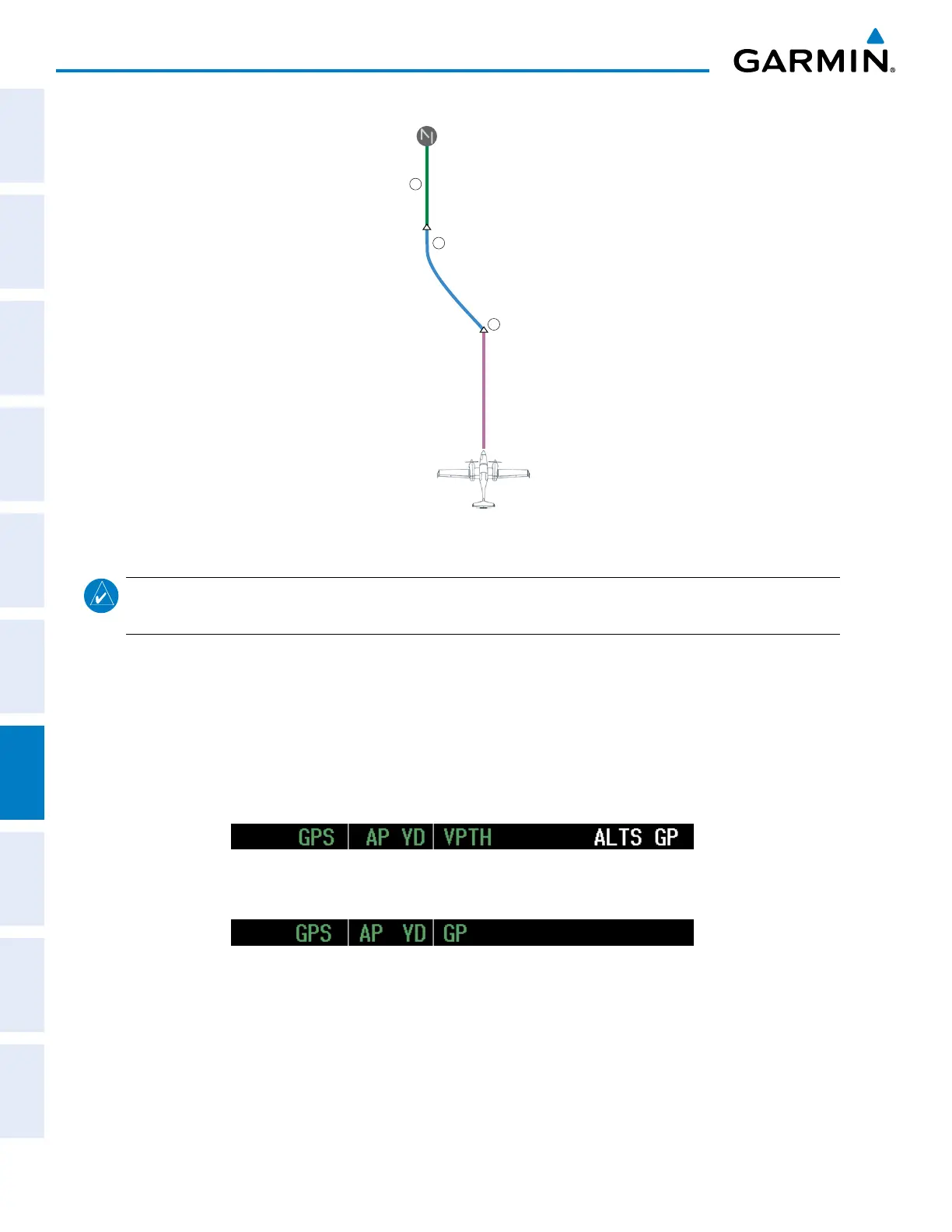
Figure 7-37 ILS Approach to KCOS
HDG Mode
LOC APR/
GS Mode
PETEY
1
2
3
GPS NAV Mode
PYNON
NOTE: Refer to the AFM to determine whether SBAS functionality is approved. Support for SBAS precision
approaches is available only in installations with GIA 63Ws when SBAS is available.
Flying a RNAV GPS approach with vertical guidance:
1) Arm flight director modes for a RNAV GPS approach with vertical guidance:
a) Make sure the navigation source is set to GPS (use CDI Softkey to change navigation source).
b) Select the Runway 35R LPV approach for KCOS. Load and activate the approach into the flight plan.
2) Press the APR Key once clearance for approach has been received. GPS Approach Mode is activated and
Glidepath Mode is armed.
3) Once the glidepath is captured, Glidepath Mode becomes active. The flight director now provides guidance to
the missed approach point.
4) There are two options available at this point, as the autopilot flies the approach:
• Push the AP DISC Switch at the Decision height and land the aircraft.
• Use the
GA Button
to execute a missed approach.

 Loading...


