43
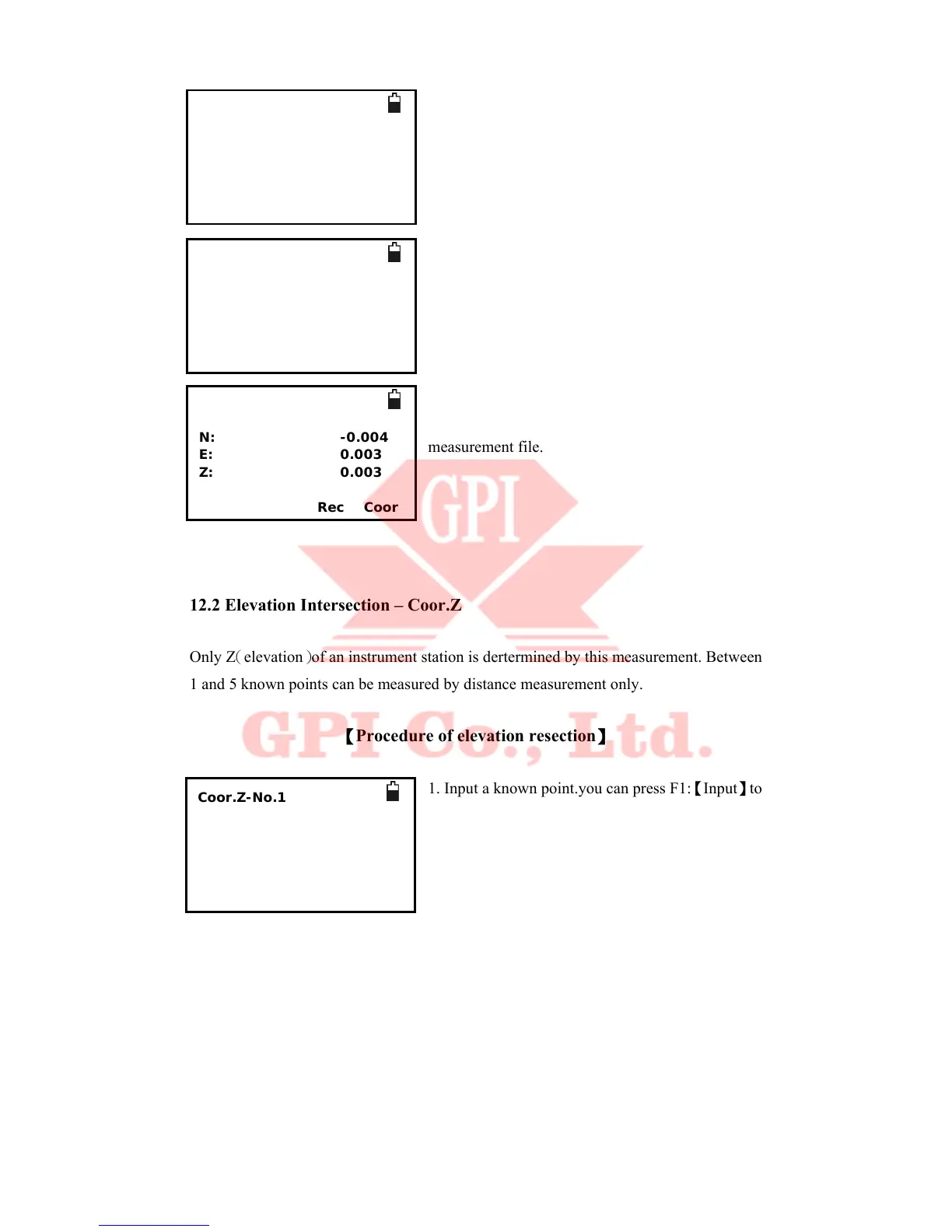
6. Press F4:【dCoor】the coordinate of instrument
station will be shown. you can Press F1:【Set ST】
to setup station and press F2:【Set A】to setup the
Azimuth of the instrument.
7. Setup station.
8. Setup the azimuth of the instrument. and you can
press F3:【Rec】to save the coordinates to current
measurement file.
12.2 Elevation Intersection – Coor.Z
Only Z(elevation)of an instrument station is dertermined by this measurement. Between
1 and 5 known points can be measured by distance measurement only.
【Procedure of elevation resection】
1. Input a known point.you can press F1:【Input】to
input the point coordinate by coordinate, or you can
press F2:【Pop】to call an existing coordinates for
current coordinates file
Intersection-result
N: -0.004
E: 0.003
Z: 0.003
Set ST SetA Rec Coor
Intersection-result
N: -0.004
E: 0.003
Z: 0.003
SetA Rec Coor
Intersection-result
N: -0.004
E: 0.003
Z: 0.003
Rec Coor
Coor.Z-No.1
>Pt.name:
Code
T.H.: 1.000
* file list
Input Pop Info Read
 Loading...