56
16. Fileman
The instrument use a FAT16 file system to manage the data, all data obtained form
measuring can save to current measurement file. the extension name of measurement
file is *.MEA. all coordinates used by measurement can be picked up from current
coordinate file, the extentsion name of current coordinate file is *.COO.sometimes you
need to note an attribute of a point when you measure, the code file maybe a good helper,
the extension name of code file is *.COD. the extension of LINE-TYPE file for roadway
is *.LSH and *.LSV, *.LSV is vertical defining file for roadway, it always is loaded
after the *.LSH.
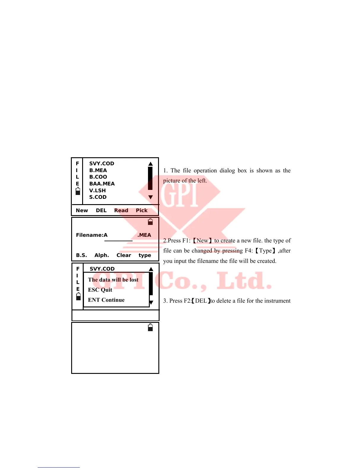
File operation is shown as follow.
1. The file operation dialog box is shown as the
picture of the left.
2.Press F1:【New】to create a new file. the type of
file can be changed by pressing F4:【Type】,after
you input the filename the file will be created.
3. Press F2:【DEL】to delete a file for the instrument.
deleting operation is dangerous ,for safty, you
should export the data first.
4. Press F3:【Read】to browse the highlight file. if
the file is coordinate file or measurement file then
the record is shown as the picture on the left.F1:
【Begin】to show the first record.F4:【End】to show
Filename:A .MEA
B.S. Alph. Clear type
F SVY.COD ▲
I B.MEA
L B.COO
E BAA.MEA
V.LSH
S.COD ▼
New DEL Read Pick
F SVY.COD ▲
I B.MEA
L B.COO
E BAA.MEA
V.LSH
S.COD ▼
New DEL Read Pick
The data will be lost
ESC Quit
ENT Continue
Pt.name DA
Code: B
T.H. 1.5000 *
HA: 24°32’20” e
VA: 89°12’30” d
Begin PgUp PgDn End
 Loading...