1-1
Section 1 Equipment Overview
1.1 Functions
This equipment determines the heading of a ship by measuring the orientation between two
antennas using the signal from GPS satellites.
The equipment not only determines the heading with high accuracy anywhere in the world and in
all weather conditions using the GPS satellites, but determines the position, course, and speed of
the ship. When the DGPS beacon receiver is connected, the accuracy of position fixing can be
enhanced by receiving correction data from the DGPS beacon station.
Since this equipment outputs the bearing information at high speed, if the unit is interfaced to a
JRC radar unit, it is possible to fully draw the capabilities of the radar and ARPA.
1.2 Features
●
High accuracy and high stability (0.5 rms degree)
●
Short setting time (less than 2 minutes at warm start fix)
● H
igh speed tracking response (Tracking rate of turn is 45 degree/sec)
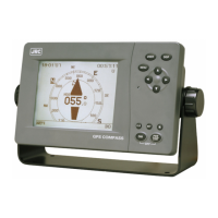
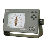
● High visibility
5.7-inch FSTN LCD
●
Many utility display modes (Compass rose graphics, ROT, NAV, GPS status, etc.)
● Easy installation
●
Direct connection to the JRC radars