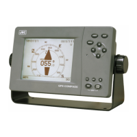
EasyManua.ls Logo

JRC JLR-30 User Manual

JRC JLR-30
118 pages
To Next Page IconTo Next Page
Page #1 background imageLoading...
Page #1 background image
01ETM
ISO 9001, ISO 14001 Certified
Printed in Japan
Marine Service Department
+81-3-3492-1305
+81-3-3779-1420
tmsc@jrc.co.jp
Telephone :
Facsimile :
e-mail :
AMSTERDAM Branch
Telephone :
Facsimile :
e-mail :
+31-20-658-0750
+31-20-658-0755
service@jrcams.nl
SEATTLE Branch
Telephone :
Facsimile :
e-mail :
+1-206-654-5644
+1-206-654-7030
service@jrcamerica.com
CODE No.7ZPNA4026CODE No.7ZPNA4026
MAR. 2007 Edition 1 JRCMAR. 2007 Edition 1 JRC
Not use the asbestos
For further information,contact:
URL http://www.jrc.co.jp
INSTRUCTIONINSTRUCTION
MANUALMANUAL
GPS COMPASSGPS COMPASS
JLR-20/30JLR-20/30

Table of Contents

Questions and Answers:

JRC JLR-30 Specifications

General IconGeneral
Frequency1575.42 MHz (L1 signal)
Accuracy10 meters (95% of the time)
Channels12 channels
DisplayLCD display
Power Supply12-24 VDC

Summary

Foreword

Before Commencing Operation

Symbols

Explains warning and caution symbols used in the manual.

Precautions Upon Operation

WARNING

Lists critical safety warnings regarding equipment modification, water exposure, voltage, magnetic interference, and battery disposal.

CAUTION

Lists precautions for environmental use, dip switches, water/oil contact, vibration, placing items on equipment, installation, batteries, and fuses.

Installation Location Guidance

Provides advice on sensor installation location, vibration avoidance, and ensuring clear signal reception.

Appearance of the Equipment

Standard Equipment

Lists standard components like NWZ-4700 Display Unit, NNN-20 Sensor Unit, and NNN-30 Sensor Unit.

Section 1 Equipment Overview

1.1 Functions

Explains the equipment's role in determining ship heading, position, course, and speed using GPS signals.

1.2 Features

Lists key features like high accuracy, short setting time, high-speed tracking, visibility, display modes, and easy installation.

1.3 Configuration

Details standard and optional equipment configurations for JLR-20 and JLR-30 models.

1.4 Construction

Provides dimensions and mass for the NWZ-4700 Display Unit.

NNN-20/30 Sensor Unit Construction

Shows dimensions and mass for NNN-20 and NNN-30 Sensor Units.

1.5 System Diagram

Illustrates the system connections between the display unit, sensor unit, and other external devices.

Section 2 Installation

Installation Cautions

Warns that installation by unauthorized personnel may lead to malfunction.

2.1 Sensor Installation

Crucial advice on sensor installation location, vibration avoidance, and signal reception.

Sensor Mounting Procedures

Describes securing the sensor unit to a mounting plate using bolts, washers, and nuts, and applying RTV rubber.

2.2 Display Unit Installation

Provides installation instructions for the display unit, including warning about magnetic compasses and mounting procedures.

2.3 Cable Connections

Explains the rear connectors of the display unit and details connections for power, sensor, and external devices.

Section 3 Names and Functions of Each Unit

3.1 NWZ-4700 Display Unit

Identifies the components and functions of the front panel of the NWZ-4700 Display Unit.

Reading the Display

Explains the symbols and characters displayed on the screen, including status, time, and measurement modes.

3.2 NNN-20/30 Sensor Unit

Shows a diagram identifying the main components of the NNN-20/30 Sensor Unit.

Section 4 Display

4.1 Display Screen Overview

Introduces the various screens available on the unit, such as Compass, Bow Heading, and Navigation screens.

4.1.1 Compass Screen

Details the graphical display of the ship's heading and its different types (A, B, C, D).

4.1.2 & 4.1.3 Display Screens

Explains the Bow Heading (numerical) and Navigation (latitude/longitude) screens.

4.1.4 Turn Rate Screen

Details the display of the ship's rate of turn, including graphic and numerical formats.

4.1.5 Water Speed / Ground Speed Screen

Explains the display of longitudinal, transverse speeds, and bearing, including current and depth if connected.

Section 5 Operation

5.1 Menu List

Provides a comprehensive list of menu options available for system configuration and settings.

5.2 Basic Operation

Outlines fundamental operations such as turning the unit on and off, and the self-diagnosis process.

Adjusting Display Settings

Details how to adjust contrast and brightness levels using dedicated keys.

5.3 Main Menu Navigation

Explains how to navigate the main menu using arrow and ENTER keys to access settings.

5.3.1 Display Settings

Details how to adjust contrast, brightness, click sound, and reversing mode through the Setup Menu.

5.3.2 Setting the Heading

Details settings related to heading restoration, backup, NMEA interrupt, check sum, offset, and output resolution.

5.3.3 GPS Configuration

Covers GPS settings such as mode (AUTO, 2D, 3D), HDOP, smoothing, and RAIM accuracy level.

5.3.3.1 Initial GPS Settings

Guides on setting initial GPS parameters like latitude, longitude, antenna height, date, and UTC time.

5.3.4 SBAS Settings

Explains SBAS settings including mode (AUTO, GPS ALONE, SBAS, BEACON), search, information, and ranging.

5.3.5 Beacon Settings

Details beacon settings like station selection, bit rate, frequency, and beacon information display.

5.3.6 System Settings

Covers system settings for time difference, date/time display, datum, speed unit, and turn rate range/smoothing.

5.3.7 Data I/O Settings

Explains data input/output settings for sensor through, data out ports, and log pulse.

5.4 Maintenance Menu

Describes how to access and use the maintenance menu for tasks like antenna check, diagnosis, and software updates.

5.4.1 Antenna Check

Details how to check sensor status, including heading, roll, pitch, and GPS reception.

5.4.3 Self-Diagnosis

Guides on performing self-diagnosis for the display unit, sensor, and LCD.

5.4.6 Master Reset

Guides on performing a master reset to restore all settings to factory defaults for display, sensor, or all.

5.4.7 Software Update

Details the procedure for updating the equipment's software, including selecting the update area and bit rate.

Section 6 Maintenance and Inspection

General Maintenance and Inspection

Provides guidelines for routine cleaning and checking of parts to ensure proper operation and lifespan.

6.2 Alarms List

Lists various alarm messages, their contents, and potential causes for the equipment.

6.3 Troubleshooting

Offers guidance on identifying and resolving common problems and their possible causes.

Section 7 After-Sales Service

Warranty and Repair Parts

Explains the standard warranty period and the availability of repair parts after production discontinuation.

Requesting Service

Provides information on what to do when the equipment malfunctions, including consulting troubleshooting and contacting support.

Section 8 Disposal

Disposal of Equipment and Batteries

Gives instructions on how to properly dispose of the equipment and its lithium battery, emphasizing safety and local regulations.

Section 9 Specifications

9.1 Display Unit Specifications

Lists detailed specifications for the NWZ-4700 Display Unit, including panel, power supply, environment, and dimensions.

External Interfaces

Details serial transmission and contact signal specifications for external device connections.

9.2 Sensor Unit Specifications

Lists electrical specifications, environment details, and dimensions/mass for the NNN-20/30 Sensor Unit.

Appendix 1 List of Geodetic Systems

Geodetic System Display Codes

Provides a table mapping screen display codes to geodetic systems used for positioning.

Appendix 2 Data Output Formats

NMEA0183 Output Sentences

Lists and defines NMEA0183 output sentences used for data transmission.

Data Sentence Formats (HDT, THS, ROT, ZDA)

Details the format and data fields for HDT, THS, ROT, and ZDA NMEA sentences.

Data Sentence Formats (GGA, VTG)

Details the format and data fields for GGA and VTG NMEA sentences, including version differences.

Data Sentence Formats (RMC, GBS)

Details the format and data fields for RMC and GBS NMEA sentences.

Data Sentence Formats (DTM, GSA)

Details the format and data fields for DTM and GSA NMEA sentences, including positioning modes and satellite information.

Data Sentence Formats (GSV, GNS)

Details the format and data fields for GSV and GNS NMEA sentences, covering satellite information and fix data.

Data Sentence Formats (MSS, GST, GLL)

Details the format and data fields for MSS, GST, and GLL NMEA sentences.

Appendix 3 Terminology

Technical Terms Glossary

Defines technical terms and abbreviations used throughout the manual, such as ARPA, COG, DGPS, HDOP, and NMEA.

Glossary Continued

Continues the definition of technical terms, including Log Pulse, Multipath Wave, NSK, RAIM, SBAS, SOG, and UTC.

Related product manuals