3ņ127
[8] Fishing Area Display
x If a fishery card is used but the fishery is not displayed, this setting gives priority to the fishery card.
On : Select this item if the fishery card is inserted in the card slot but the fishery is not displayed.
The fishery is displayed by giving priority to the fishery card over other cards.
Off : Select this item if the fishery card is not to be used. If the fishery card is used but the
fishery is displayed, the setting can be left off.
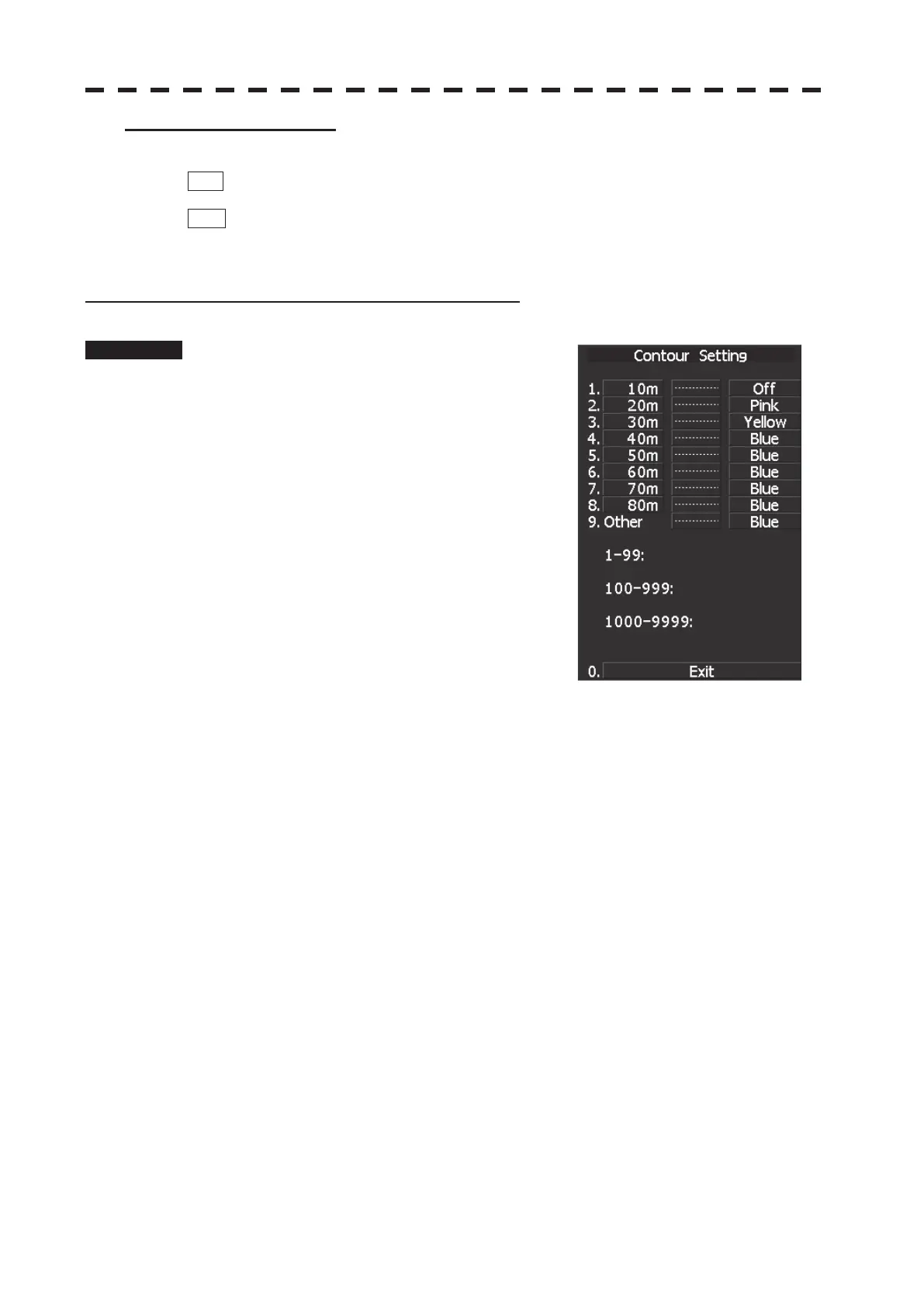
Setting Contour Lines on Chart (Contour Setting)
Procedure 1 Press [RADAR MENU] key.
Press [9] key.
Press [5] key.
Or, hold down the [Map] key.
Sea chart menu (Map Setting) opens.
2 Press [4] key.
JRC depth contour display menu (Contour
Setting) opens.
Depths and display colors can be set for 9
contour lines in total: 8 for depth specification
and 1 for other depths.
3 Select the number of depth to be changed, pressing the numeric key.
The depth input screen will appear. Enter the value as the depth to be set.
Subsequently, the display line list will appear.
4 Select the number to be set, pressing the numeric key.
The selected color to represent the contour lines of the depth will be set.
To change the settings of other depths, repeat steps 3 and 4.
 Loading...