10
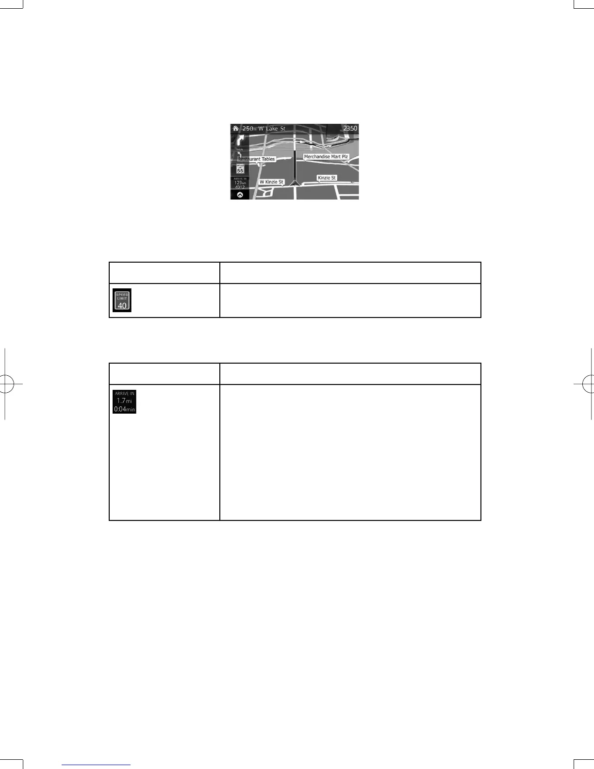
2.3 Map screen
2.3.1 Navigating on the map
The data fi elds are different when you are navigating an active route and when you have no
specifi ed destination (the orange line is not displayed).
Default data fi elds when cruising without a destination (select and hold any of the fi elds to
change its value):
Field Description
Shows the speed limit of the current road if the map contains it.
Default data fi elds when navigating a route (select and hold any of the fi elds to change its
value):
Field Description
Shows the distance you need to travel on the route before
reaching your fi nal destination.
Shows the estimated arrival time at the fi nal destination of the
route based on information available for the remaining segments
of the route.
If [DEVICE] is capable of receiving live traffi c information, the
calculation takes into account traffi c delays affecting your route if
they are received. However, this calculation is rarely accurate.
Historical traffi c data can also be taken into account if data is
available.
NAV-6AVUAE.indb10NAV-6AVUAE.indb10 2013/05/0718:21:402013/05/0718:21:40
 Loading...