4.2 Saturn Bt – Chapter 4. System␣␣
System Satellites
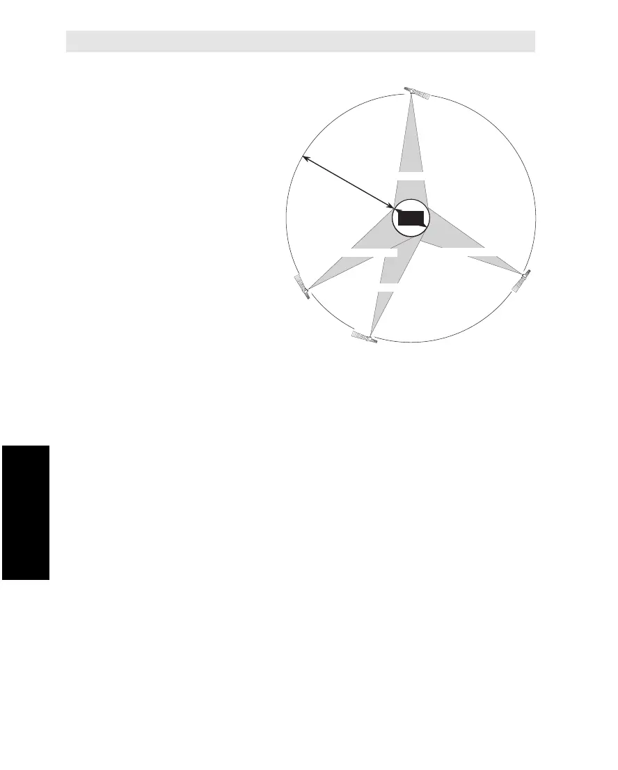
The positions of the four sys-
tem satellites are indicated in
Figure 4.2.
The satellites are posi-
tioned in a geostation-
ary orbit above the
equator at approxi-
mately 35700 km
altitude.
In geostationary orbit,
each satellite moves at
the same rate as the
earth, and so remains in
the same relative position
to the earth.
The satellites cover approximately 1/4 of the earth each, called
Ocean Regions:
•Atlantic Ocean East Region
•Pacific Ocean Region
•Indian Ocean Region
•Atlantic Ocean West Region
The four Ocean Regions represent areas within which SaturnB can
communicate via a selected satellite.
The coverage area of the satellites is shown on the map in
appendixA.
Description Cont’d
E
Q
U
A
T
O
R
E
A
R
T
H
12000 km
35700 km
Pacific Ocean Region
Indian Ocean Region
54
°W
6
4
.5
°E
178°E
15.5°W
Atlantic Ocean Region (West)
Atlantic Ocean Region (East)
Figure 4.2 Satellite positions.
Description Cont’d