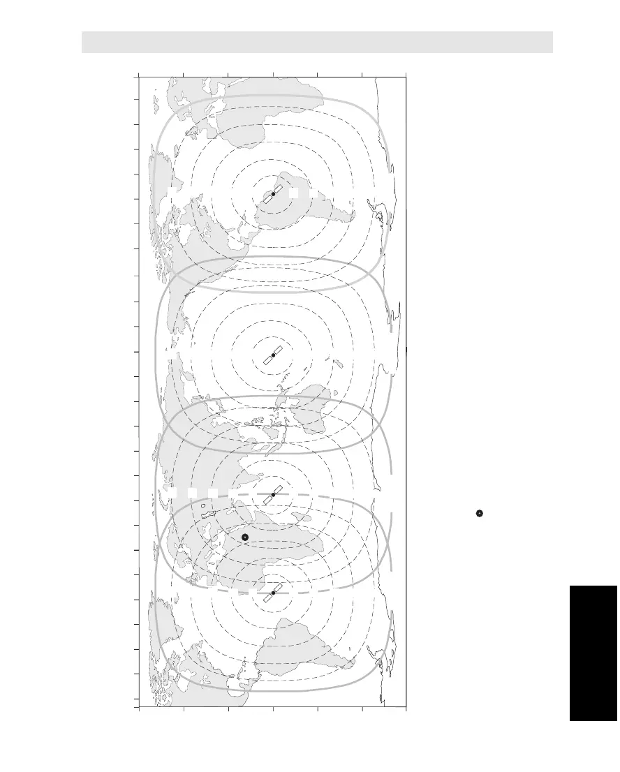
Atlantic Ocean Region East
AOR-E
Indian Ocean Region
IOR
Pacific Ocean Region
POR
Atlantic Ocean Region West
AOR-W
180100 E 120 E 140 E 160 E40 E 60 E 80 E20 W 0 20 E80 W 60 W 40 W100 W
LONGITUDE
140 W 120 W160 W 20 W 0 20 E80 W 60 W 40 W100 W
LATITUDE
60 N
30 N
0
30 S
60 S
LATITUDE
60 N
30 N
0
30 S
60 S
5° Elevation
5° Elevation
5° Elevation
5° Elevation
Example:
Elevation angle for the plotted position
41° for the AOR-E satellite
50 ° for the IOR satellite
Be careful not to read the wrong angle in
areas where two satellites overlap.
15
45
60
75
75
60
45
30
15
30
15
45
60
75
75
60
45
30
15
30
15
45
60
75
75
60
45
30
15
30
15
45
60
75
75
60
45
30
15
30