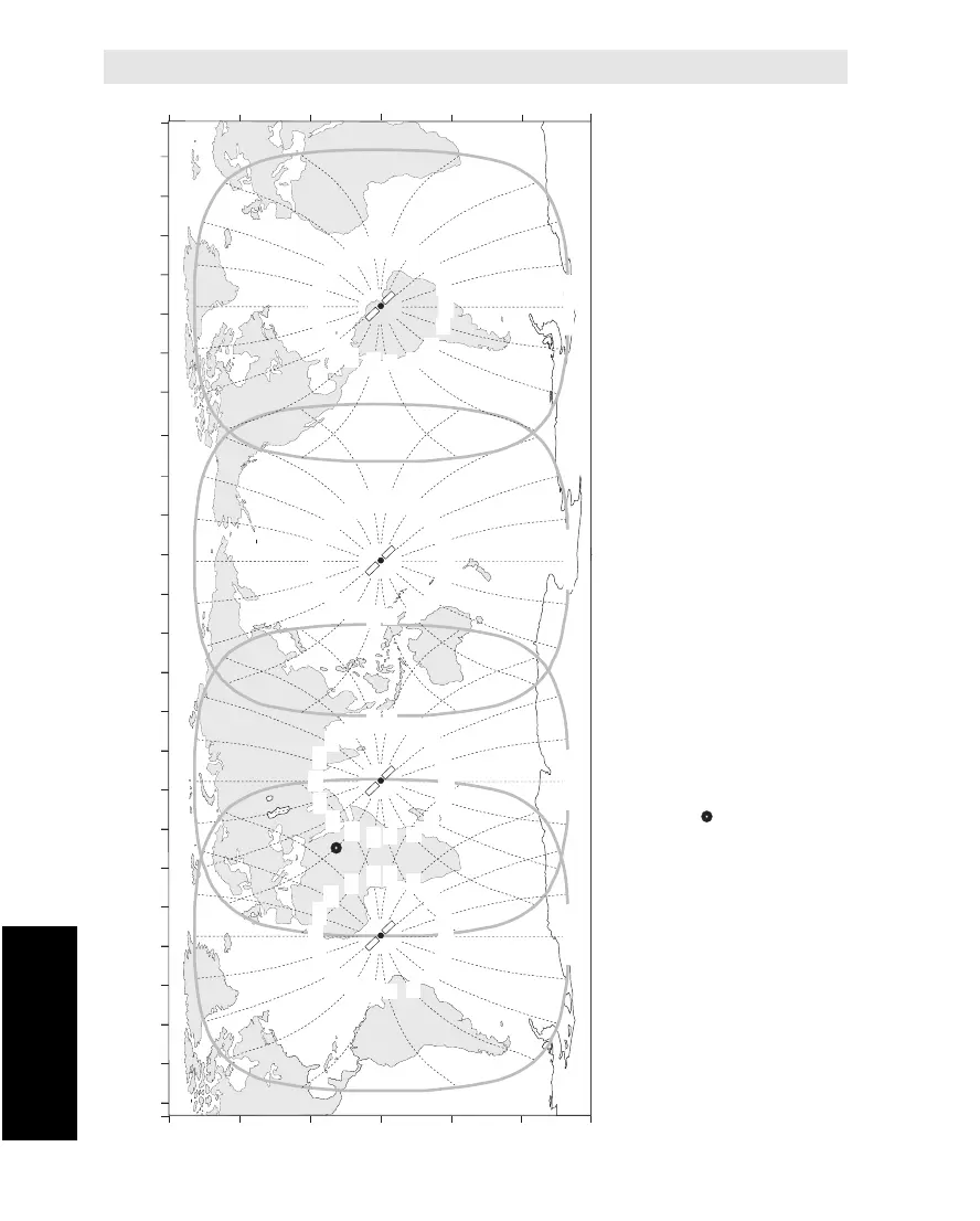
Atlantic Ocean Region East
AOR-E
Indian Ocean Region
IOR
Pacific Ocean Region
POR
Atlantic Ocean Region West
AOR-W
180100 E 120 E 140 E 160 E40 E 60 E 80 E20 W 0 20 E80 W 60 W 40 W100 W
LONGITUDE
140 W 120 W160 W 20 W 0 20 E80 W 60 W 40 W100 W
LATITUDE
60 N
30 N
0
30 S
60 S
LATITUDE
60 N
30 N
0
30 S
60 S
5° Elevation
5° Elevation
5° Elevation
5° Elevation
Example:
Azimuth angle for the plotted position
247° for the AOR-E satellite
119° for the IOR satellite
Be careful not to read the wrong angle in
areas where two satellites overlap.
180
200
220
240
260
280
300
320
340
360
160
140
120
100
80
60
40
20
180
200
220
240
260
280
300
320
340
360
160
140
120
100
80
60
40
20
180
200
220
240
260
280
300
320
340
360
160
140
120
100
80
60
40
20
180
200
220
240
260
280
300
320
340
360
160
140
120
100
80
60
40
20