26
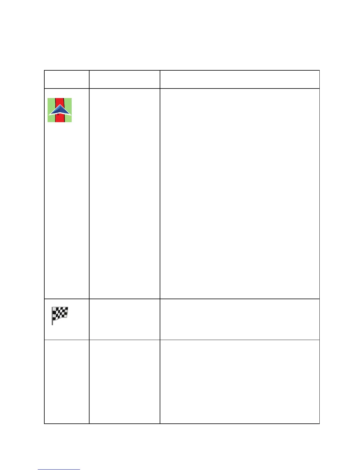
2.3.3.5 Elements of the active route
your software shows the route in the following way:
Symbol Name Description
Current GPS
position and
Start point
Your current position displayed on
the map.
• In pedestrian mode it is the
exact GPS position.
• If a vehicle is selected for
route calculation and roads
are near, the symbol is
snapped onto the nearest
road.
Normally if GPS position is
available, the route starts from the
current position. If there is no valid
GPS position, your software uses
the last known position as the start
point.
Destination
(end point)
The last point of the route.
Map color The map is vivid and colorful when
GPS position is available.
Whenever the current position is not
available, the map turns gray. The
software however may still move the
Vehimarker to show a possible but
not confirmed position.
 Loading...