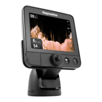
Do you have a question about the Raymarine A60 and is the answer not in the manual?
Critical warnings and precautions for device operation and handling.
Details compatibility and requirements for using electronic charts.
Details all physical buttons, rotary knob, and trackpad functions.
Explains how to choose and split display pages for Chart and Fishfinder.
Describes how to use the built-in simulator for practice.
Separates controls into Keys and Soft Keys.
How to customize the display presentation for work flow.
How to change chartplotter and cartography settings.
Defines parameters used across all A60 applications.
How to configure and receive warnings for hazards and events.
Controls appearance options for the A60 display.
Detailed instructions and cautions for CF card handling.
How to save/retrieve waypoints, routes, and tracks to CF card or via NMEA.
Guides on how to create waypoints at cursor, current, or known positions.
Explains how to navigate to a saved waypoint using cursor or list.
Covers changing default symbols, names, and other waypoint details.
Methods to move waypoints by coordinates or dragging.
How to remove waypoints from the system.
How to create, save, and follow navigation routes.
Explains different methods to follow a created route.
Explains how to use tracks to review or retrace journeys.
Modifying a route by adding, moving, or removing waypoints.
How to display graphical indicators for navigation.
Options for chart orientation: North Up, Head Up, Course Up.
Displaying details of port services by selecting port symbols or using search.

