Chapter 4-2 EQ33 Pilot menu
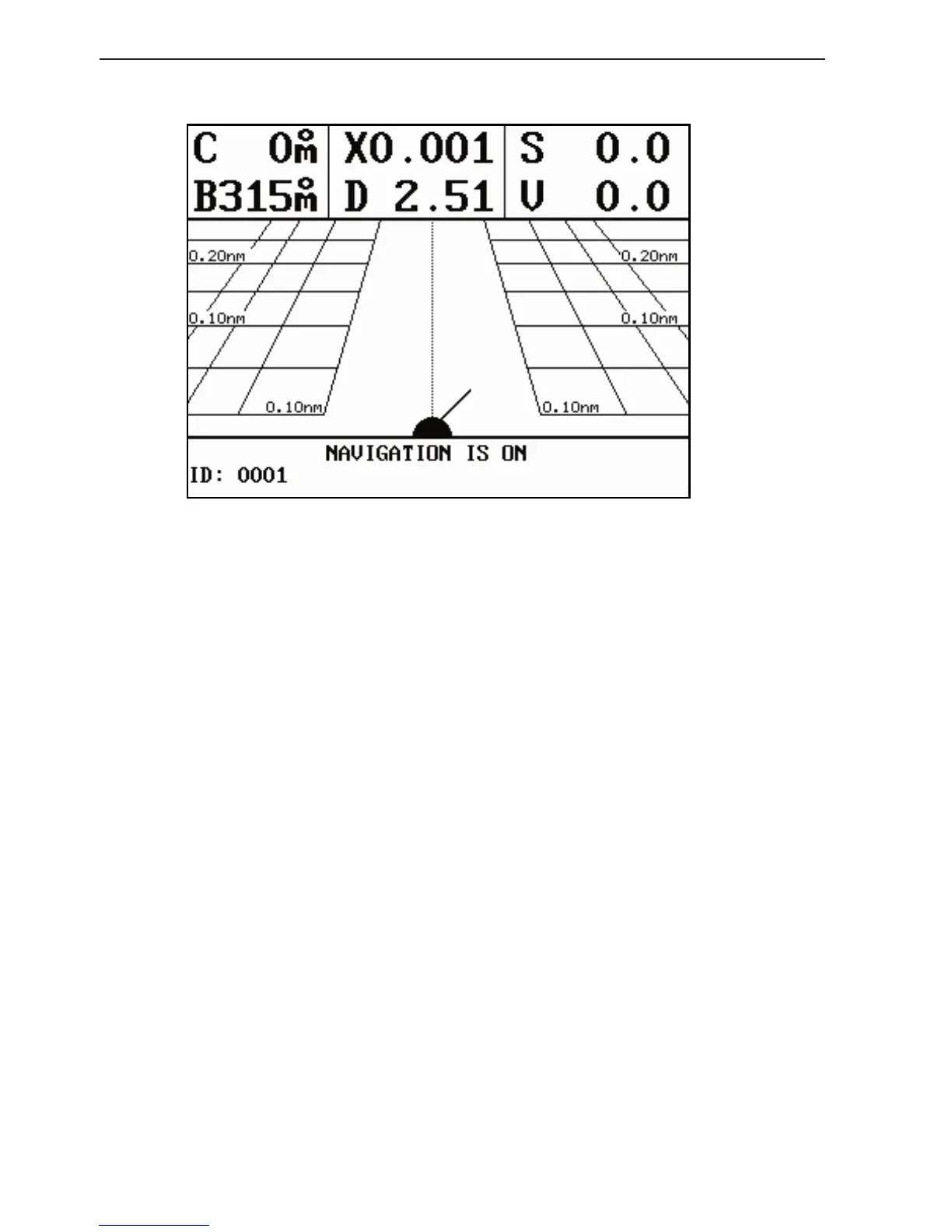
Highway display (with active navigation mode)
Nautical miles indication on horizontal lines indicates how many
nautical miles there are from ship’s position to the horizontal line.
C: Course over ground
X: Cross-track-error
S: Speed over ground
B: Bearing to approaching WP
D: Distance to waypoint
V: Speed towards WP (velocity)
Bottom line indicates name/number of approaching waypoint or
routepoint.
Ship’s position and heading in relation to intended track.
Ideal course line between two waypoints starting from ship’s
position when a navigation mode is activated on connected navi-
gator.
XTE alarm lines - an alarm will sound if the ship touches the
lines.