© Adolf Thies GmbH & Co. KG · Hauptstraße 76 · 37083 Göttingen · Germany 021408/04/21
Phone +49 551 79001-0 · Fax +49 551 79001-65 · info@thiesclima.com ·www.thiesclima.com Page 12 of 13
4 Operational Characteristics
Definitions:
The „Relative Wind“, the heading and the ship’s speed must be available for calculation of
the „True Wind“. The “Relative Wind” is measured by means of a wind transmitter installed
on the ship’s bow. Heading and ship’s speed are received via the following NMEA telegrams:
telegram
VBW COM 3 --- 2 SOG > SOW **
HDT COM 2 1 --- ---
VTG COM 3 X X only with
*: Priority (Top: 1)
** With the VBW telegrams the SOG values („speed over ground“) have priority before the
SOW values („speed over water“).
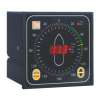
• True Wind
Reference direction of the True Wind is geographic North. Zero degrees corresponds to
wind from the north with an increasing angle in a clockwise direction.
• Relative Wind
Reference direction of the Relativen Wind is the ship’s longitudinal axis. Zero degrees is
indicated in direction of the ship’s bow and corresponds to wind from the front. The angle
of relative wind direction increases in a clockwise direction.
Conversion of the parameters at hand into „True Wind“ takes place as follows:
Calculation of True Wind
The vector Relative Wind Velocity (RWV) is made up of the two vectors Speed Over Ground
(SOG) and True Wind Velocity (TWV).
RWV = SOG + TWV
The relative wind velocity (RWV) is hereby measured by means of an anemometer and a vane
on the ship, the Speed Over Ground is transmitted via a serial interface and the True Wind
Velocity is calculated:
TWS = RWS - SOG
This vector subtraction is carried out in an orthogonal coordinate system, which is connected
to the ship.