Do you have a question about the TomTom VIO and is the answer not in the manual?
Guide to installing the app, starting the device, and initial setup.
Steps for Bluetooth pairing, reconnection, and connecting to different phones.
Instructions and precautions for securely mounting the VIO device on a scooter.
How to charge, manage background operation, and reset the VIO device.
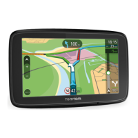
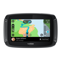
Explanation of real-time traffic information and its benefits for route planning.
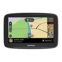
How to search for addresses, POIs, and contacts, and enter search terms.
Step-by-step guide to planning routes using the search function for addresses or POIs.
How to plan a route specifically to a city centre using the search function.
Navigating and selecting a destination directly on the map to plan a route.
How to plan routes to saved locations stored in 'My Places'.
Planning routes using contacts from 'My Places' or your smartphone's contacts app.
How to find and select alternative routes to avoid delays or obstacles.
Overview of the Current Route menu options for managing your active route.
Adding/reordering stops, changing route types, and navigating around blockages.
Introduction to saving routes and the process of saving a planned route.
How to select and navigate a previously saved route from your list.
Introduction to My Places and setting home/work locations.
Information on the speed camera warning service and how warnings are provided.
A guide to symbols and descriptions for different types of speed cameras.
Explanation of danger zones and risk zones, especially in France, and their warnings.
Critical safety advice on GPS, audio systems, and responsible driving practices.
Safety guidelines for users with pacemakers and other medical devices.
| Motorcycle | Yes |
|---|---|
| Marine (chartplotters, sounders) | No |
| Languages support | Multi |
| Traffic Message Channel (TMC) | - |
| Map coverage | All Europe |
| Lifetime map updates | Roads change, but with Lifetime Map Updates your map will always be up to date. Start fresh every few months by downloading a new edition of the industry's most accurate map. New editions are issued four times per year. |
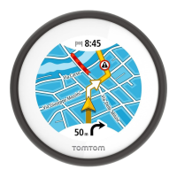
| Display diagonal | 2.4 \ |
| Display resolution | 320 x 320 pixels |
| Compatible memory cards | Not supported |
| Internal storage capacity | 0.001 GB |
| Form factor | Fixed |
| Product color | Black |
| International Protection (IP) code | IPX7 |
| Power source type | Battery |
| Battery life (max) | 5 h |
| Cables included | USB |
| Depth | 106 mm |
|---|---|
| Width | 103 mm |
| Height | 107 mm |
| Weight | 310 g |