Setting up the Machine and 3DMC
mmGPS 3D Paver Reference Manual
3-84
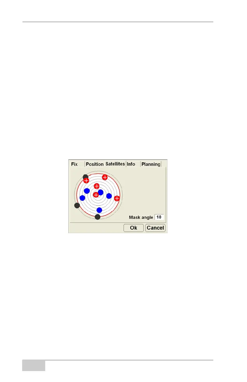
Monitor Satellites and Enter Mask Angle
To monitor the current distribution of satellites or enter the mask
angle for satellites, press the GPS status button, then tap the
Satellites tab on the GPS status dialog box.
The Satellites tab displays the following information (Figure 3-91):
• Satellite plot – displays used and unused satellites, and the
current mask angle.
– Blue dots: GPS satellites
– Red-with-cross dots: GLONASS satellites
– Black dots: unused satellites
– Red mask circle: satellites inside are used for positioning
• Mask angle – enter the mask angle for the jobsite.
Figure 3-91. GPS Info – Satellites Tab
View Receiver Information or Reset Receiver
The Info tab displays the following (Figure 3-92 on page 3-85):
• Identification information, firmware revision, and radio link
information (type, latency, and quality) for the GPS receiver in
the MC-2.5 Receiver Box.
• Reset RTK – press to reset RTK ambiguities.
• Reset receiver – press to clear all data and reset all settings stored
for the MC-2.5 Receiver Box.
 Loading...