CHCNAV RS10 USER MANUAL | 2024-04 P a g e | 24
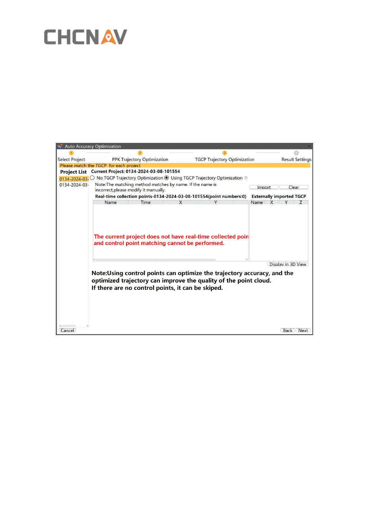
▪ Click “next” to set TGCP trajectory optimization parameters:
Use trajectory control points to correct the accuracy of SLAM and transform the point cloud
from a relative coordinate system to a projected coordinate system. This function can only be
used if trajectory control points are collected during data acquisition. Click on "Import" to
import the control point file in txt or csv format. The control points will be matched with the
trajectory control points collected in the field based on their names.