~
Select (check) currently highlighted
II!!!!!!!!lJ
item
IIrr-
l
IInformation about
~urrent
location
'.-":'1
on the map, mode Items
Reset button
Cancel button
Delete button (Move cell content to
Trash can)
Voice instractions are activated
a
1-·--.·
..
·.···.1
.
.'
-
',"
11II
-
I_I
Display spell mode
I
_I
Page
up,
page down
in
.'
displayed list
IAIlyl Step up or step down
on
menu list
3.
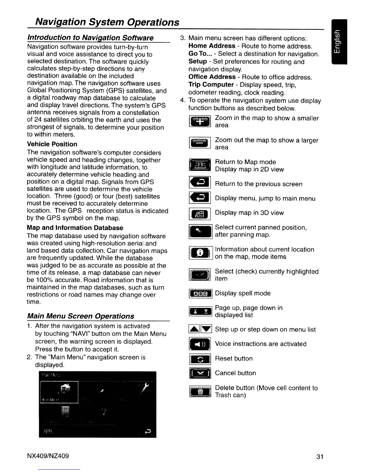
Main menu screen has different options:
Home Address - Route to home address.
Go
To
... - Select a destination for navigation.
Setup - Set preferences for routing and
navigation display.
Office Address - Route to office address.
Trip Computer - Display speed, trip,
odometer reading, clock reading.
4.
To
operate the navigation system use display
function buttons as described below.
riiIiiiiIl.···
..
~,
Zoom
in
the map to show a smaller
~
area
IIf"II
Zoom out the map to show a larger
area
•
Return to Map mode
Display map in 2D view
Iell Return to the previous screen
• Display menu, jump to main menu
IIiiII Display map
in
3D view
~_
, Select cur:ent panned position,
after pannmg map.
Introduction to Navigation Software
Main Menu Screen Operations
Navigation System Operations
1.
After the navigation system is activated
by
touching "NAVI" button
om
the Main Menu
screen, the warning screen is displayed.
Press the button to accept
it.
2.
The "Main Menu" navigation screen is
displayed.
Navigation software provides turn-by-turn
visual and voice assistance to direct you to
selected destination. The software quickly
calculates step-by-step directions to any
destination available
on
the included
navigation map. The navigation software uses
Global Positioning System (GPS) satellites, and
a digital roadway map database to calculate
and display travel directions. The system's GPS
antenna receives signals from a constellation
of 24 satellites orbiting the earth and uses the
strongest of signals, to determine your position
to within meters.
Vehicle Position
The navigation software's computer considers
vehicle speed and heading changes, together
with longitude and latitude information, to
accurately determine vehicle heading and
position on a digital map. Signals from GPS
satellites are used to determine the vehicle
location. Three (good) or four (best) satellites
must be received to accurately determine
location. The GPS reception status is indicated
by
the GPS symbol
on
the map.
Map and Information Database
The map database used
by
navigation software
was created using high-resolution aerial and
land based data collection. Car navigation maps
are frequently updated. While the database
was judged to be as accurate as possible at the
time of its release, a map database can never
be 100% accurate. Road information that is
maintained
in
the map databases, such as turn
restrictions or road names may change over
time.
NX409/NZ409
31

 Loading...