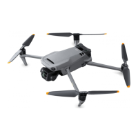
DJI Mavic 3E/3T User Manual
21
©
2022 DJI All Rights Reserved.
Failsafe RTH
The action of the aircraft when the remote controller signal is lost can be set to RTH, land,
or hover in DJI Pilot 2. If the Home Point was successfully recorded and the compass is
functioning normally, Failsafe RTH automatically activates after the remote controller signal
is lost for more than six seconds.
When the lighting is sufficient and the vision systems are working normally, DJI Pilot 2 will
display the RTH path that was generated by the aircraft before the remote controller signal
was lost and return to home using Advanced RTH according to the RTH settings. The aircraft
will remain in RTH even if the remote controller signal is restored. DJI Pilot 2 will update the
RTH path accordingly.
When the lighting is not sufficient and the vision systems are not available, the aircraft will
enter Original Route RTH.
Original Route RTH Procedure:
1. The aircraft brakes and hover in place.
a. If the aircraft is farther than 50 m from the Home Point, the aircraft adjusts its
orientation and flies backward for 50 m on its original flight route before entering
Straight Line RTH.
b. If the aircraft is farther than 5 m but less than 50 m from the Home Point, it enters
Straight Line RTH.
c. The aircraft lands immediately if it is less than 5 m from the Home Point when RTH
begins.
2.
3. The aircraft lands and the motors stop after reaching the Home Point.
The aircraft will enter or remain in Straight Line RTH if the remote controller signal is
restored during RTH.
• The aircraft may not be able to return to the Home Point normally if the GNSS signal
is weak or unavailable. The aircraft may enter ATTI mode if the GNSS signal becomes
weak or unavailable after entering Failsafe RTH. The aircraft will hover in place for a
while before landing.
• It is important to set a suitable RTH altitude before each flight. Launch DJI Pilot 2 and
set the RTH altitude. The default RTH altitude is 100 m.
• The aircraft cannot avoid obstacles during Failsafe RTH if the vision systems are
unavailable.
• GEO zones may affect the RTH. Avoid flying near GEO zones.
• The aircraft may not be able to return to a Home Point when the wind speed is too
high. Fly with caution.
• Be aware of small or fine objects (such as tree branches or power lines) or transparent
objects (such as water or glass) during RTH. Exit RTH and control the aircraft manually
in an emergency.
• RTH may not be available in some environments even if the vision systems are working.
The aircraft will exit RTH in such cases.
 Loading...