DJI Mavic 3E/3T User Manual
69
©
2022 DJI All Rights Reserved.
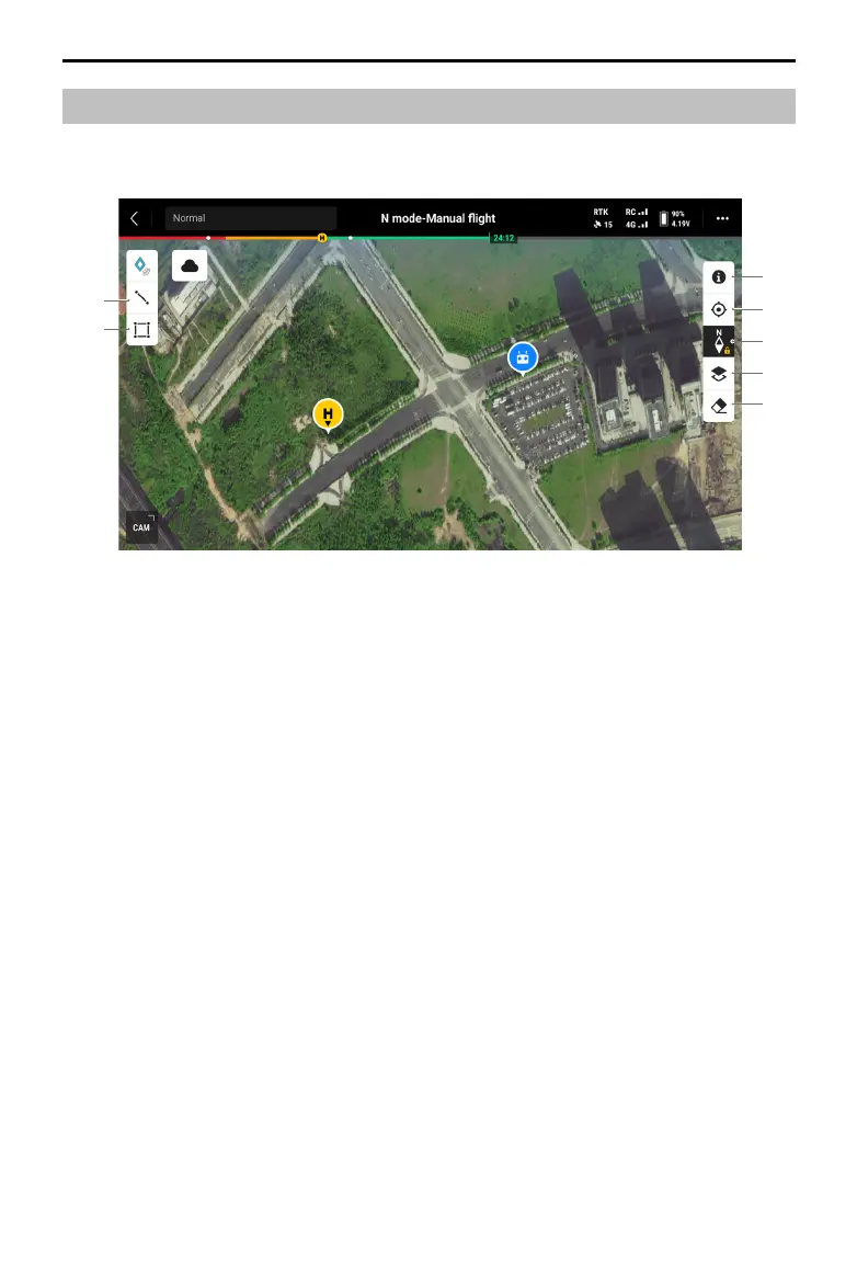
Map View
4
3
5
6
7
1
2
1. Tap to draw a line on the map.
2. Tap to draw an area on the map.
3. Tap to clear the flight route of the aircraft.
4. Map Layer Selection: tap to select a satellite or street map (standard mode) according to
operational requirements.
5. Map Lock: when enabled, the map cannot be rotated; when disabled, the map can be
rotated freely.
6. Recenter View: tap to quickly center the remote controller location in the view.
7. GEO Zone Map Layers: tap to view all GEO Zone layers and enable or disable the GEO
Zones layer display on the map.
 Loading...