7. MAINTENANCE, TROUBLESHOOTING
7-11
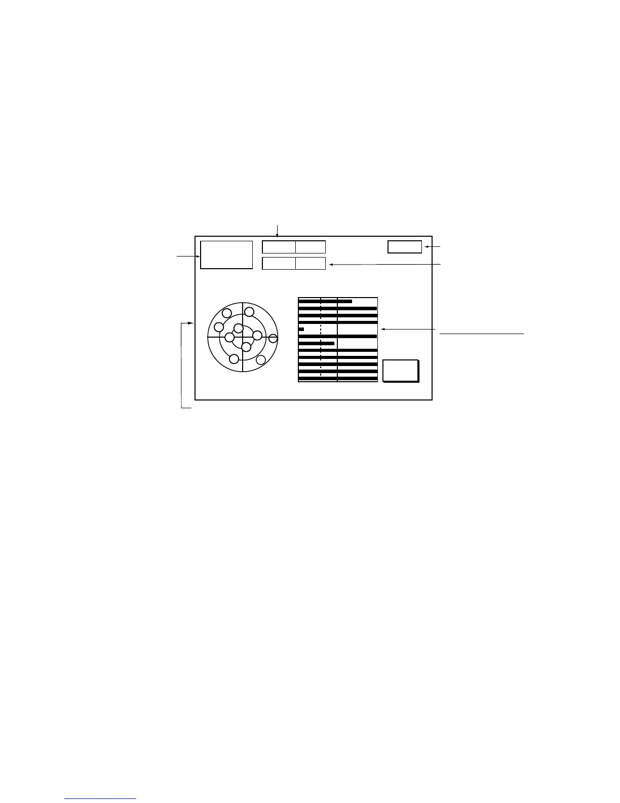
7.7 GPS Status Display
The GPS status display provides data about the GPS satellites. It is available
with connection of the GPS Receiver GP-310B or a GPS navigator outputting
the data sentence GSA or GSV.
1. Press the [MENU] key.
2. Press the SYSTEM CONFIGURATION, NAV OPTION and GPS SENSOR
SETTINGS soft keys to display the GPS SENSOR SETTINGS menu.
3. Press the GPS STATUS soft key.
RETURN
23:59:59
APR 10 2001
Date
and
Time
DOP value
Receive signal level
Bars show satellite
signal levels. Satellites
whose signal level
extends past 40 are
used to fix position.
GPS antenna height
Estimated position of satellite in the sky.
Satellites used for fixing position are circled.
23
12
29
27
01
17
26
05
20
21
30
28
30
40 50
DOP
1.2
ALT
1 m
W
N
S
E
21
12
23
20
29
05
27
17
28
30
01
26
SAT
No.
SNR
GPS 3D
GPS position fix
GPS status display
4. Press the RETURN soft key to quit the GPS status display.
 Loading...