Garmin G1000 Cockpit Reference Guide for the Columbia 350/400
190-00567-01 Rev. A
SECTION 7 – NAVIGATION
7-21
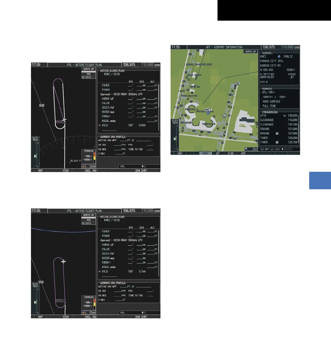
26)
The aircraft continues climbing to “AT or ABOVE”
10,000 feet at MOGAL. A holding pattern will be
established at the MAHP (MOGAL) as shown in
Figure 7-49.
Figure 7-49 Establishing the Holding Pattern
27)
The aircraft maintains 10,000 feet while following
the magenta line through the hold as in Figure 7-
50.
Figure 7-50 Hold Established
7.4 AIRPORT INFORMATION
Figure 7-53 Airport Information Page
Select the Airport Information Page
1)
Turn the large
FMS
Knob to select the ‘WPT’ page
group.
2)
Turn the small
FMS
Knob to select the first
rectangular page icon. Initially, information for the
airport closest to the aircraft’s present position is
displayed.
Select an Airport from the Database
1)
With the Airport Information Page displayed, press
the
FMS
Knob to activate the cursor.
2)
Enter the desired airport identifier.
Select an Airport from the Active Flight Plan
1)
With the Airport Information Page displayed, press
the
FMS
Knob to activate the cursor.
2)
Turn the small
FMS
Knob to the left to display a list
of flight plan airports as shown in Figure 7-54.
 Loading...