Garmin G1000 Cockpit Reference Guide for the Columbia 350/400
190-00567-01 Rev. A
SECTION 6 – AUTOMATIC
FLIGHT CONTROL
6-26
Flying a Flight Plan/GPS Course
NOTE: Changing the navigation source cancels
Navigation Mode and causes the flight director
to revert back to Roll Hold Mode (wings rolled
level).
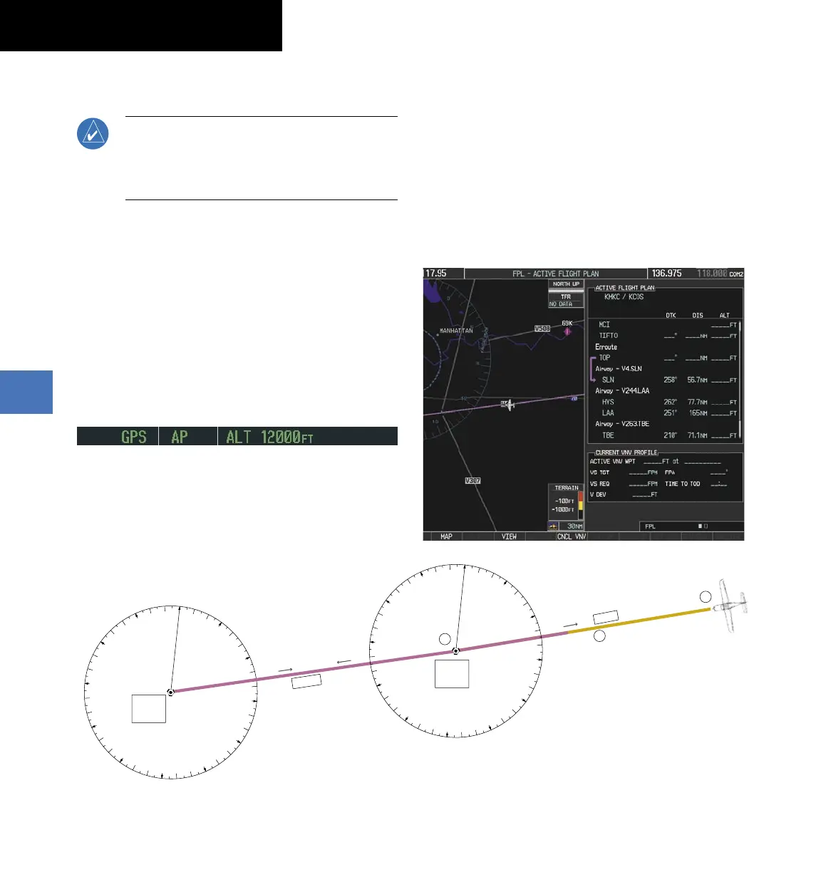
As the aircraft approaches the Salina VOR, GPS is used
to navigate the next leg, airway V244.
Flying a GPS flight plan:
1)
Transition from VOR to GPS Navigation Mode:
a) Press the
CDI
Softkey until GPS is the selected
navigation source.
b) Press the
NAV
Key to activate GPS Navigation
Mode. The autopilot guides the aircraft along
the active flight plan leg.
Figure 6-32 Transition to GPS Flight Plan
0
3
6
9
12
15
18
21
24
27
30
33
VO
R NA
V Mode
GP
S
NA
V Mod
e
V 24
4
Hays
VO
R
(HYS)
1
2
3
Salina
VOR
(SLN)
V
4
0
76
o
075
o
2
6
0
o
0
3
6
9
12
15
18
21
24
27
30
33
2)
Following the flight plan, the autopilot continues
to steer the aircraft under GPS guidance. Note that
in GPS Navigation Mode, course changes defined
by the flight plan are automatically made without
pilot action required.
 Loading...