Garmin G1000 Cockpit Reference Guide for the Columbia 350/400
190-00567-01 Rev. A
10-3
SECTION 10 – HAZARD
AVOIDANCE
Change the viewing mode between 360
˚
and
120˚:
1)
Select the Stormscope Page.
2)
Select the
VIEW
Softkey. The
360
and
ARC
Softkeys
are displayed. Select the 360 Softkey to display
a 360˚ viewing area or select the ARC Softkey to
display a 120˚ viewing area.
Select the
CLEAR
Softkey to remove all Stormscope
lightning data from the display.
10.3 XM
®
WEATHER (OPTIONAL)
WARNING: XM Weather is not intended to
be used for hazardous weather penetration.
Weather information provided by XM Radio
Service is approved only for weather avoidance,
not penetration.
1)
Select the
MAP
Softkey.
2)
Select the
NEXRAD or XM LTNG
Softkey to display
the desired weather. Select the applicable softkey
again to remove weather data from the Navigation
Map Page.
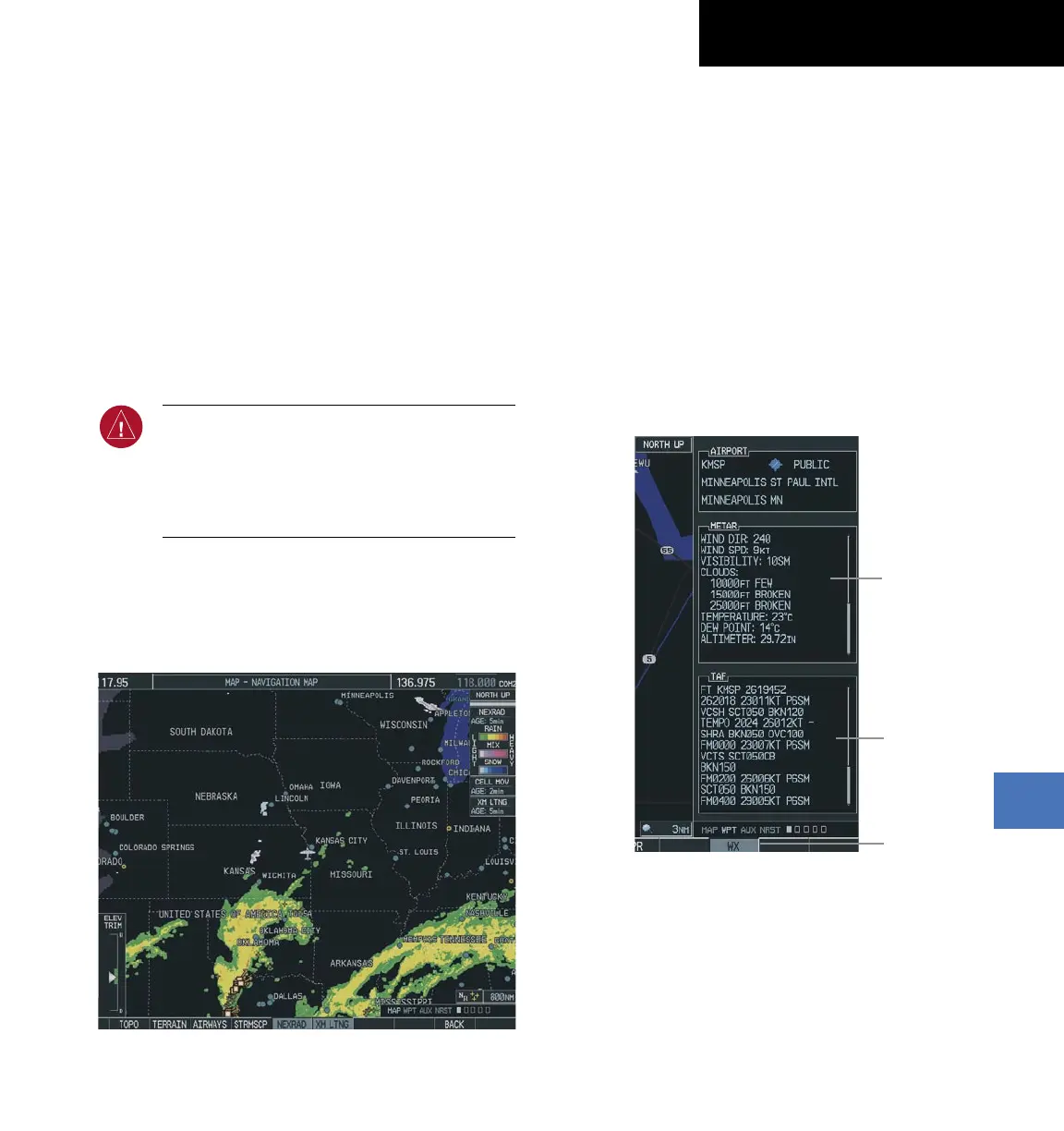
Figure 10-7 Navigation Map Page Displaying NEXRAD Weather
Displaying METAR and TAF information on the
Airport Information Page
Display METAR and TAF text on the Airport
Information Page:
1)
Turn the large
FMS
Knob to select the WPT Page
Group.
2)
Turn the small
FMS
Knob to select the Airport
Information Page.
3)
Select the WX Softkey to display METAR and TAF
text (METAR and TAF information is updated every
12 minutes).
Figure 10-8 METAR and TAF Text Displayed on the
Airport (Weather) Information Page
METAR
Text
TAF
Text
WX
Softkey
 Loading...