Garmin G1000 Cockpit Reference Guide for the Columbia 350/400
190-00567-01 Rev. A
10-14
SECTION 10 – HAZARD
AVOIDANCE
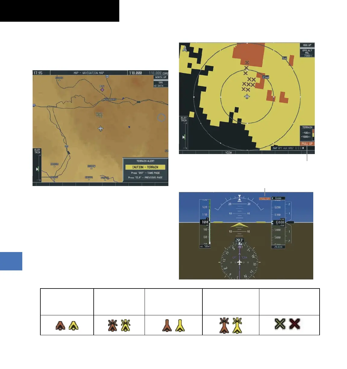
Pop-up Alerts
When the Navigation Map Page is displayed, and a
terrain or obstacle alert is issued, a pop-up window is
displayed with the appropriate alert.
Figure 10-22 Alert Pop-Up
Press the ENT Key to display the TAWS Page, or press
the CLR Key to remain on the Navigation Map Page.
Displaying Terrain and Obstacles on the
Navigation Map
1)
With the Navigation Map displayed, select the
MAP
Softkey.
2)
Select the
TERRAIN
Softkey. Terrain and obstacle
proximity will now be displayed on the map.
Unlighted Obstacle
(Height is less than
1000’ AGL)
Lighted Obstacle
(Height is less than
1000’ AGL)
Unlighted Obstacle
(Height is greater than
1000’ AGL)
Lighted Obstacle
(Height is greater than
1000’ AGL)
Potential Impact Points
Figure 10-23 TAWS Symbols
Alert Annunciations
Figure 10-24 Alert Annunciation on the TAWS Page
Alert Annunciation
Alert Annunciation
Figure 10-25 Alert Annunciation on the PFD
 Loading...