Garmin G1000 Cockpit Reference Guide for the Columbia 350/400
190-00567-01 Rev. A
2-11
SECTION 2
FLIGHT INSTRUMENTS
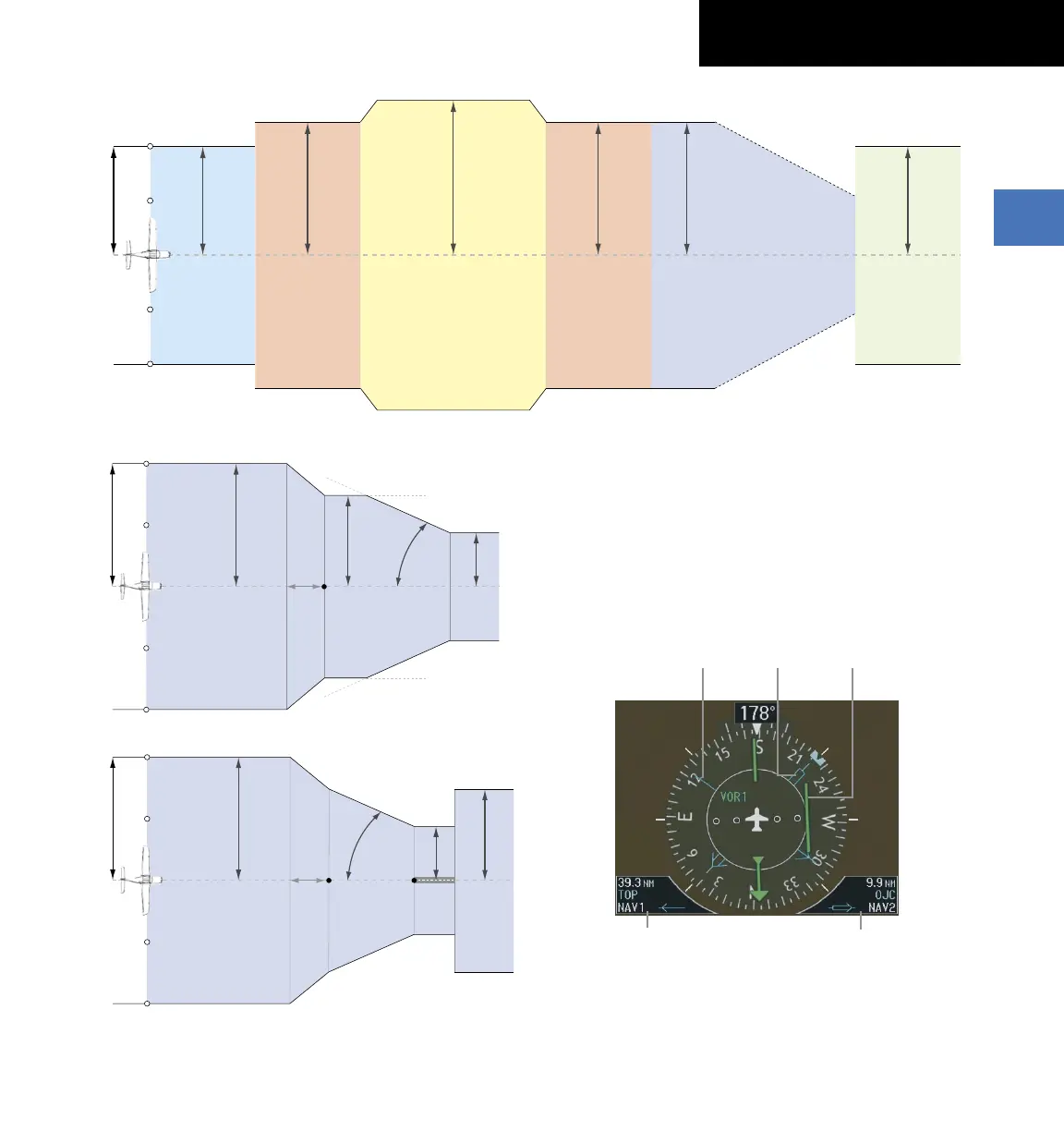
2.0 nm
Enroute
(Oceanic if >200 nm
from nearest airport)
0.3 nm
Missed
Approach
1.0 nm
Approach
1.0 nm
Terminal
1.0 nm
Terminal
0.3 nm
Departure
CDI Full-scale Deflection
31 nm from Destination Airport
30 nm from Departure Airport
Refer to accompanying
approach CDI scaling figures
Drawing not to scale
Figure 2-23 Phases of Flight/CDI Scaling
1.0 nm
2 nm
350 ft
angle set
by system
0.3 nm
FAF
CDI Full-scale Deflection
CDI scale is set to the smaller of 0.3 nm
or an angle set by the syste
m
CDI scale varies if Vectors-To-Final is activated
Drawing not to scale
Figure 2-24 Typical LNAV and LNAV+V Approach CDI Scaling
1.0 nm
2 nm
FAF
0.3 nm
course width
Landing
Threshold
CDI Full-scale Deflection
angle based
on database
information
CDI scale varies if Vectors-To-Final is activated
Drawing not to scale
Figure 2-25 Typical LNAV/VNAV and LPV Approach CDI Scaling
(WAAS Systems Only)
Bearing Pointers and Information Windows
Selecting the PFD Softkey provides access to the BRG1
and BRG2 Softkeys. The BRG1 Pointer is a single line
pointer. The BRG2 Pointer is a double line pointer.
Bearing 2
Pointer
Bearing 1
Information
Window
Bearing 1
Pointer
Bearing 2
Information
Window
Figure 2-26 HSI with Bearing Information
CDI
 Loading...