190-00962-04 Rev. A
Garmin G1000 Pilot’s Guide for the Diamond DA42NG
531
ADDITIONAL FEATURES
SYSTEM
OVERVIEW
FLIGHT
INSTRUMENTS
EIS
AUDIO PANEL
& CNS
FLIGHT
MANAGEMENT
HAZARD
AVOIDANCE
AFCS
ADDITIONAL
FEATURES
APPENDICES INDEX
While the APPROACH Box is selected using the FMS Knob, the G1000 softkeys are blank. Once the desired
chart is selected, the chart scale can be changed and the chart page can be scrolled using the Joystick. Pressing
the Joystick centers the chart on the screen.
The aircraft symbol is shown on the chart only if the chart is to scale and the aircraft position is within
the boundaries of the chart. The aircraft symbol is not displayed when the Aircraft Not Shown Icon appears
(Figure 8-29). If the Chart Scale Box displays a banner NOT TO SCALE, the aircraft symbol is not shown. The
Aircraft Not Shown Icon may appear at certain times, even if the chart is displayed to scale.
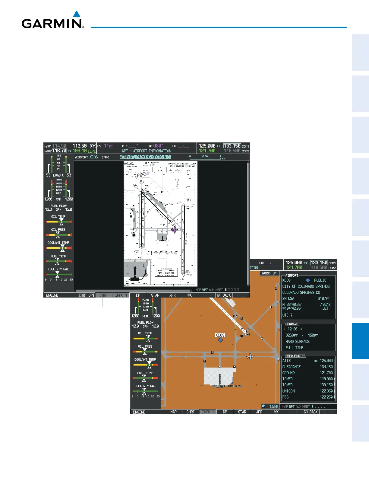
Pressing the CHRT Softkey switches between the ChartView diagram and the associated map in the WPT
page group. In the example shown, the CHRT Softkey switches between the Colorado Springs, CO (KCOS)
Airport Diagram and the navigation map on the WPT – Airport Information page.
Figure 8-26 CHRT Softkey, Airport Information Page
Press
CHRT
Softkey
to Switch Between
ChartView and WPT -
Airport Information Page

 Loading...


