Garmin G1000 Pilot’s Guide for the Diamond DA42NG
190-00962-04 Rev. A532
ADDITIONAL FEATURES
SYSTEM
OVERVIEW
FLIGHT
INSTRUMENTS
EIS
AUDIO PANEL
& CNS
FLIGHT
MANAGEMENT
HAZARD
AVOIDANCE
AFCS
ADDITIONAL
FEATURES
APPENDICESINDEX
Pressing the INFO-1 or INFO-2 Softkey returns to the airport diagram when the view is on a different chart.
If the displayed chart is the airport diagram, the INFO-1 or INFO-2 Softkey has no effect.
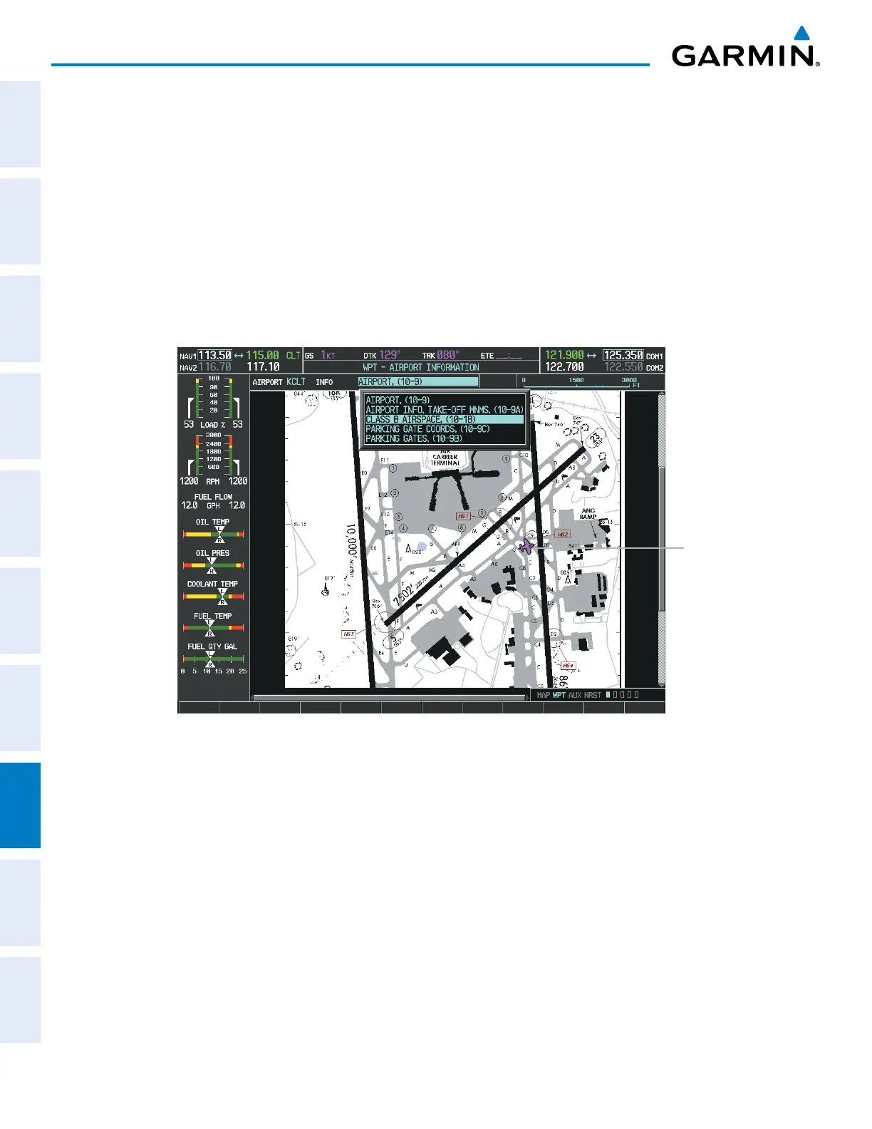
The aircraft position is shown in magenta on the ChartView diagrams when the location of the aircraft is within
the chart boundaries. In the example shown, the aircraft is turning onto Taxiway Romeo on the Charlotte, NC
(KCLT) airport.
Another source for additional airport information is from the INFO Box above the chart for certain airports.
This information source is not related to the INFO-1 or INFO-2 Softkey. When the INFO Box is selected using
the FMS Knob, the G1000 softkeys are blank. The Charlotte, NC airport has five additional charts offering
information; the Airport Diagram, Take-off Minimums, Class B Airspace, Airline Parking Gate Coordinates, and
Airline Parking Gate Location. (The numbers in parentheses after the chart name are Jeppesen designators.)
Aircraft
Current
Position
Figure 8-27 Airport Information Page, INFO View, Full Screen Width

 Loading...


