Radar
WARNING
The marine radar transmits microwave energy that has the potential to be harmful to humans and animals.
Before beginning radar transmission, verify that the area around the radar is clear. The radar transmits a beam
approximately 12° above and below a line extending horizontally from the center of the radar.
To avoid possible personal injury, do not look directly at the antenna at close range when the radar is
transmitting. Eyes are the most sensitive part of the body to electromagnetic energy.
When you connect your compatible chartplotter to an optional Garmin marine radar, such as a GMR
™
Fantom
™
6
radar or a GMR 24 xHD, you can view more information about your surroundings.
The radar transmits a narrow beam of microwave energy as it rotates to a 360° pattern. When the transmitted
energy contacts a target, some of that energy is reflected back to the radar.
Radar Interpretation
Reading and interpreting the radar display takes practice. The more you use the radar, the better you will
become at relying on the radar display when you really need it.
Radar can be useful in many situations, such as avoiding collisions when you have limited visibility, for example
when it is dark or foggy, tracking weather, seeing what is ahead of you, and locating birds and fish.
The radar overlay feature can help you interpret the radar display more easily, because it overlays the radar
returns on top of the chart. This can help you identify the difference between a radar return of a land mass,
bridge, or rain cloud. Showing the AIS vessels on the radar overlay can also help you identify features on the
radar display.
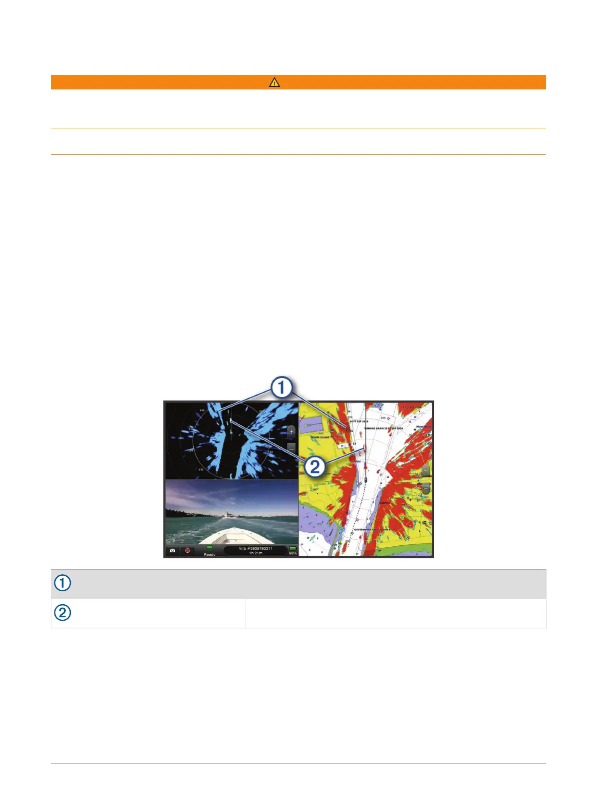
In the screenshot below, the radar overlay is turned on. This screen also shows a video feed. We can easily
identify a few items on the radar screen.
Land
Vessel
Radar Overlay
When you connect your chartplotter to an optional Garmin marine radar, you can use overlay radar information
on the Navigation chart or on the Fishing chart.
Data appears on the radar overlay based on the most recently used radar mode and all settings configurations
applied to the radar overlay are also applied to the last-used radar mode.
Radar 93
 Loading...