EasyManuals Logo

Garmin GPSMAP 1243xsv User Manual

Garmin GPSMAP 1243xsv
208 pages
To Next Page IconTo Next Page
To Previous Page IconTo Previous Page
Page #98 background imageLoading...
Page #98 background image
Turning On the A-Scope
NOTE: This feature is available in the Traditional sonar views.
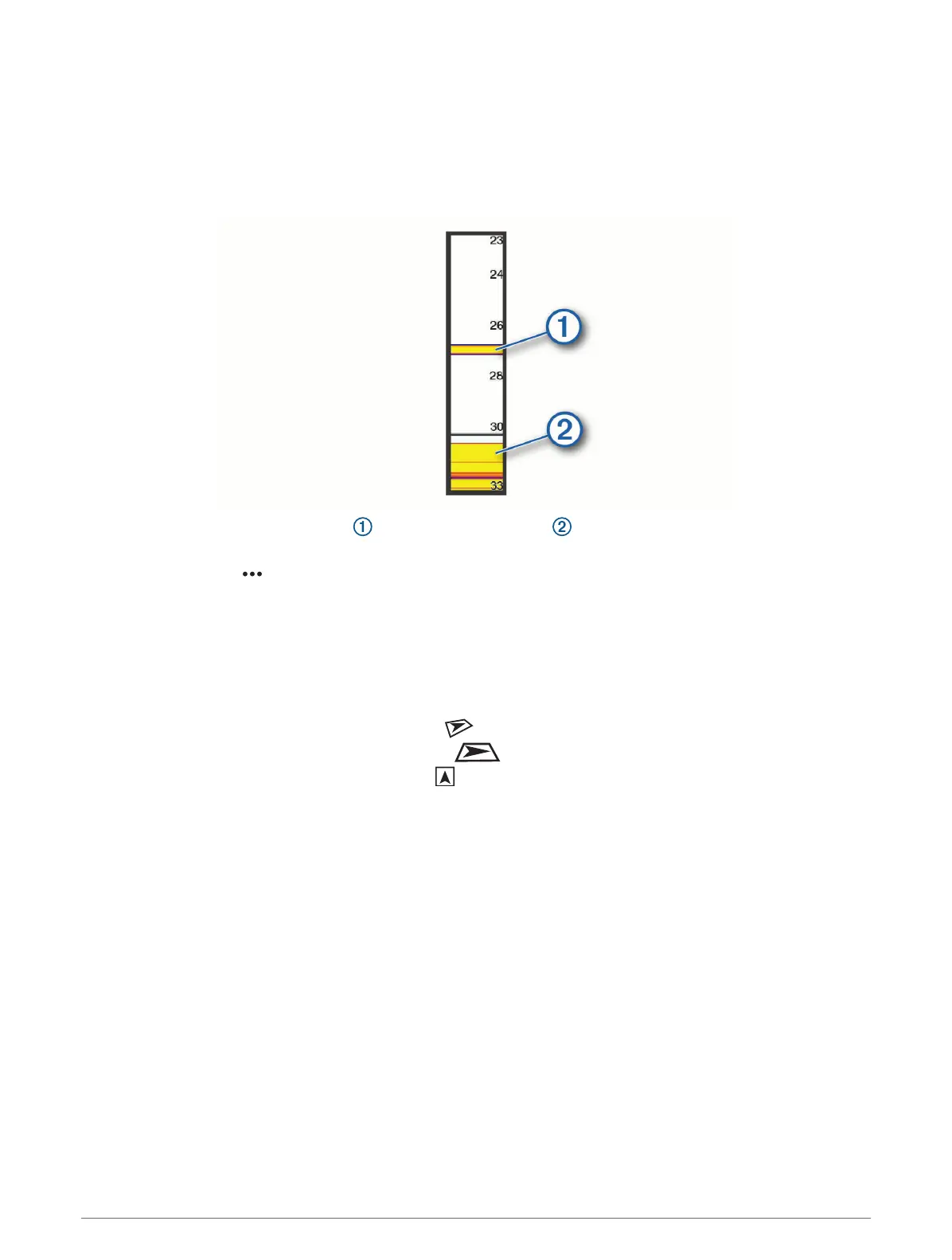
The a-scope is a vertical flasher along the right side of the view, showing you what is underneath the transducer
right now. You can use the a-scope to identify target returns that may be missed when the sonar data is
quickly scrolling across the screen, such as when your boat is moving at high speeds. It can also be helpful for
detecting fish that are close to the bottom.
The a-scope above shows fish returns and a soft bottom return .
1 From a sonar view, select Options > Sonar Setup > Appearance > A-Scope.
2 If necessary, select > Peak Hold to adjust the length of time the sonar returns are displayed.
Panoptix Sonar Setup
Adjusting the RealVü Viewing Angle and Zoom Level
You can change the viewing angle of the RealVü sonar views. You can also zoom in and out of the view.
From a RealVü sonar view, select an option:
To adjust the viewing angle diagonally, select .
To adjust the viewing angle horizontally, select .
To adjust the viewing angle vertically, select .
To adjust the viewing angle, swipe the screen in any direction.
To zoom in, spread two fingers apart.
To zoom out, pinch two fingers together.
Adjusting the RealVü Sweep Speed
You can update how quickly the transducer sweeps back and forth. A faster sweep rate creates a less detailed
image, but the screen refreshes faster. A slower sweep rate creates a more detailed image, but the screen
refreshes more slowly.
NOTE: This feature is not available for the RealVü 3D Historical sonar view.
1 From a RealVü sonar view, select Options > Sweep Speed.
2 Select an option.
86 Sonar Fishfinder

Table of Contents

Questions and Answers:

Question and Answer IconNeed help?

Do you have a question about the Garmin GPSMAP 1243xsv and is the answer not in the manual?

Garmin GPSMAP 1243xsv Specifications

General IconGeneral
Display Resolution1280 x 800 pixels
Display TypeWXGA display
TouchscreenYes
KeypadYes
Water RatingIPX7
AntennaInternal or external over NMEA 2000
Receiver10 Hz
Garmin Marine Network Ports2
NMEA 2000 Ports1
NMEA 0183 Input Ports1
NMEA 0183 Output Ports1
Wireless ConnectivityYes
J1939 ConnectivityYes
BlueChart g3 ChartsYes
LakeVü g3 ChartsYes
Waypoints5, 000
Routes100
Track Log50, 000 points; 50 saved tracks
Sonar CapabilitiesYes
CHIRP SonarYes
ClearVüYes
SideVüYes
Traditional Sonar Frequency50/77/83/200 kHz
ClearVü/SideVü Frequency260/455/800 kHz
Weight5.1 lbs (2.3 kg)
Mounting OptionsFlush
Video Input Ports1 BNC
Accepts Data CardsmicroSD card
CHIRP FrequencyLow, High
Transmit Power500 W (RMS)
Operating Temperature-15°C to 55°C (5°F to 131°F)
Storage Temperature-4°F to 158°F (-20° to 70°C)
Power Input10-32 Vdc

Related product manuals