EasyManuals Logo

Garmin GPSMAP 1243xsv User Manual

Garmin GPSMAP 1243xsv
208 pages
To Next Page IconTo Next Page
To Previous Page IconTo Previous Page
Page #185 background imageLoading...
Page #185 background image
Setting the Keel Offset
You can enter a keel offset to compensate the water depth reading for the transducer installation location. This
allows you to view the depth of the water below the keel or the true depth of the water, depending on your
needs.
If you want to know the water depth below the keel or the lowest point of your boat and the transducer is
installed at the water line or anywhere above the end of the keel, measure the distance from the transducer
location to the keel of the boat.
If you want to know the true water depth and the transducer is installed below the water line, measure the
distance from the bottom of the transducer up to the water line.
NOTE: This option is only available when you have valid depth data.
1 Measure the distance:
If the transducer is installed at the water line or anywhere above the end of the keel, measure the
distance from the transducer location to the keel of the boat. Enter this value as a positive number.
If the transducer is installed at the bottom of the keel and you want to know the true depth of the
water, measure the distance from the transducer to the water line. Enter this value in as a negative
number.
2 Complete an action:
If the transducer is connected to the chartplotter or a sonar module, select Settings > My Vessel > Depth
and Anchoring > Keel Offset.
If the transducer is connected to the NMEA 2000 network, select Settings > Communications > NMEA
2000 Setup > Device List, select the transducer, and select Review > Keel Offset.
3 Select if the transducer is installed at the water line, or select if the transducer is installed at the
bottom of the keel.
4 Enter the distance measured in step 1.
Device Configuration 173

Table of Contents

Questions and Answers:

Question and Answer IconNeed help?

Do you have a question about the Garmin GPSMAP 1243xsv and is the answer not in the manual?
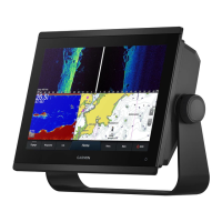
Garmin GPSMAP 1243xsv Specifications

General IconGeneral
Display Resolution1280 x 800 pixels
Display TypeWXGA display
TouchscreenYes
KeypadYes
Water RatingIPX7
AntennaInternal or external over NMEA 2000
Receiver10 Hz
Garmin Marine Network Ports2
NMEA 2000 Ports1
NMEA 0183 Input Ports1
NMEA 0183 Output Ports1
Wireless ConnectivityYes
J1939 ConnectivityYes
BlueChart g3 ChartsYes
LakeVü g3 ChartsYes
Waypoints5, 000
Routes100
Track Log50, 000 points; 50 saved tracks
Sonar CapabilitiesYes
CHIRP SonarYes
ClearVüYes
SideVüYes
Traditional Sonar Frequency50/77/83/200 kHz
ClearVü/SideVü Frequency260/455/800 kHz
Weight5.1 lbs (2.3 kg)
Mounting OptionsFlush
Video Input Ports1 BNC
Accepts Data CardsmicroSD card
CHIRP FrequencyLow, High
Transmit Power500 W (RMS)
Operating Temperature-15°C to 55°C (5°F to 131°F)
Storage Temperature-4°F to 158°F (-20° to 70°C)
Power Input10-32 Vdc

Related product manuals