Adindan Adindan- Ethiopia, Mali,
Senegal, Sudan
Afgooye Afgooye- Somalia
AIN EL ABD 70 AIN EL ANBD 1970-
Bahrain Island, Saudi
Arabia
Anna 1 Ast 65 Anna 1 Astro 65- Cocos I.
ARC 1950 ARC 1950- Botswana,
Lesotho, Malawi,
Swaziland, Zaire, Zambia,
Zimbabwe
ARC 1960 Kenya, Tanzania
Ascnsn Isld 58 Ascension Island 58-
Ascension Island
Astro B4 Sorol Atoll Sorol Atoll- Tern Island
Astro Beacon E Astro Beacon E- Iwo Jima
Astro Dos 71/4 Astro Dos 71/4- St. Helena
Astr Stn 52 Astronomic Stn 52-
Marcus Island
Astrln Geod 66 Australian Geod 66-
Australia, Tasmania Island
Astrln Geod 84 Australian Geod 84-
Australia, Tasmania Island
Austria Austria
Bellevue (IGN) Efate and Erromango
Islands
Bermuda 1957 Bermuda 1957- Bermuda
Islands
Bogata Observ Bogata Obsrvatry-
Colombia
Campo Inchspe Campo Inchauspe-
Argentina
Canton Ast 66 Canton Astro 1966-
Phoenix Islands
Cape Cape- South Africa
Cape Canavrl Cape Canaveral- Florida,
Bahama Islands
Carthage Carthage- Tunisia
CH-1903 CH 1903- Switzerland
Chatham 1971 Chatham 1971- Chatham
Island (New Zealand)
Chua Astro Chua Astro- Paraguay
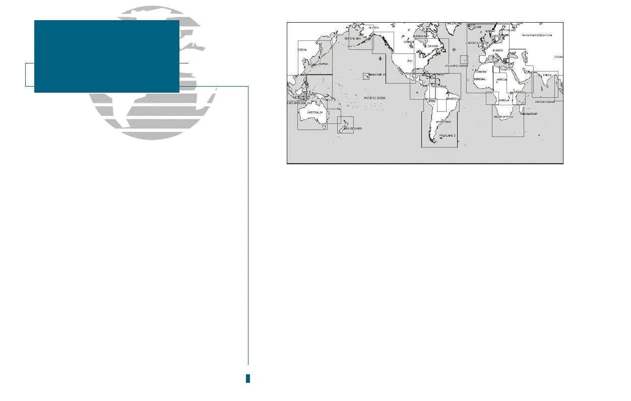
The GPSMAP 180s built-in worldwide data-
base includes chart coverage down to 64 nm
(120 km) for the areas outlined above. Note that
the GPSMAP database is only valid to 68º15 of
latitude. The maximum cursor latitude is 85º05,
and the maximum waypoint latitude is
89º24.543 north or south.
74
SECTION
D
APPENDIX
Map Datums