IntuVue RDR-4000 Weather Radar Pilot's Guide
060-4492-000 Expanded Operating Instructions
Rev 7, February 2015 25
FULL COVERAGE GROUND MAP MODE (MAP)
The RDR-4000 Weather Radar System can be used in Ground Map
mode to identify terrain features. For ground mapping use the following
procedure:
1. System Control
: L/R (or NORM)
2. Mode
: MAP
3. Range
: As desired
4. Gain
: If necessary, adjust for
optimum observation of
terrain features.
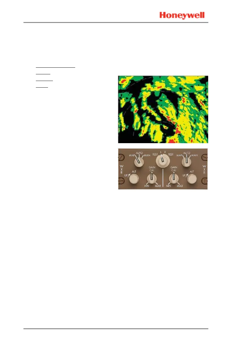
The purpose of the MAP mode is
to aid in identifying prominent
terrain features, such as
coastlines, lakes, and large built-
up urban areas. MAP mode
provides an extended ground
map picture by piecing together
individual scans and combining
them in the memory for display.
Reflectivity data that is considered
ground clutter (and removed from
the weather views) is the basis for
the Ground Map. Data from the
topography database is not used,
providing an independent verification of position. The Ground Map is
generated automatically and simultaneously with weather.
See the following pictures for a comparison of a MAP display and a
satellite photo of the same area.
 Loading...