* Optional items. You turn the optional items on/off individually
from the GPS settings dialog.
Vessel symbol
When the system has a valid GPS position lock, the vessel symbol
indicates vessel position. If no GPS position is available, the vessel
symbol includes a question mark.
GPS plotter page scale
You zoom in and out on the GPS plotter page by using the Zoom
keys.
The GPS plotter page range scale is shown in the lower right corner
of the page.
Panning the GPS plotter image
You can move the image in any direction by using the Arrow keys
to move the cursor to the edge of the panel in the desired direction.
To remove the cursor and cursor elements from the page, press the
Cursor/Waypoint key. This also centers the image to the vessel
position.
Positioning the vessel on the page
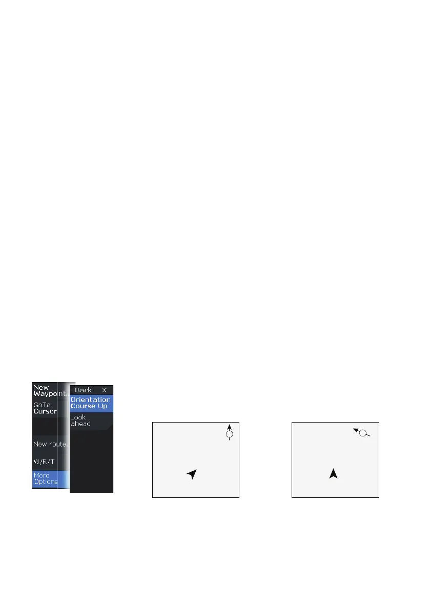
GPS image orientation
You can specify how the GPS image is rotated in the panel. The
orientation symbol in the panel’s upper right corner indicates the
north direction.
North up
Course up
GPS plotter | Hook² X Series Operator Manual