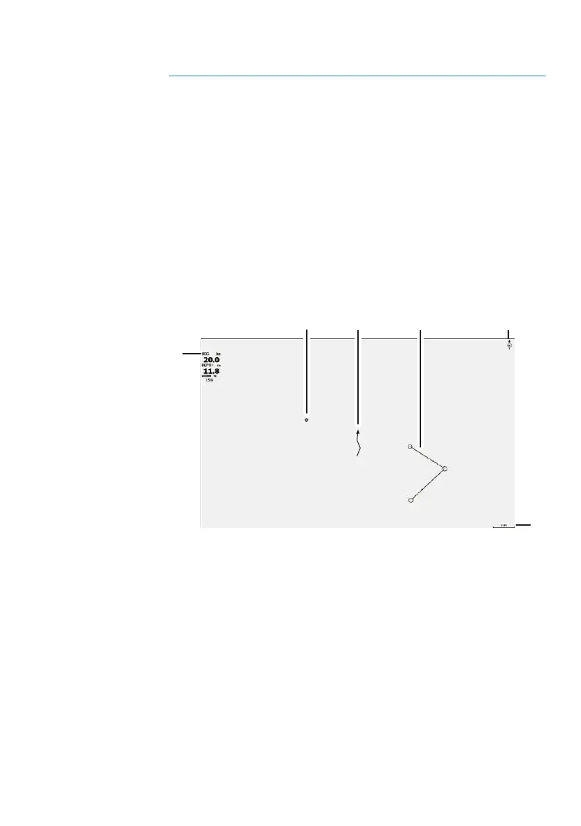
EasyManuals Logo

Lowrance HOOK2-4x User Manual

Lowrance HOOK2-4x
27 pages
To Next Page IconTo Next Page
To Previous Page IconTo Previous Page
Page #10 background imageLoading...
Page #10 background image
GPS plotter
Ú
Note: The GPS plotter page is not available on 4x Sonar only
models.
The GPS plotter page displays your vessel’s position. On the GPS
plotter page you can plan and navigate routes, see your vessel's
trail, and place waypoints.
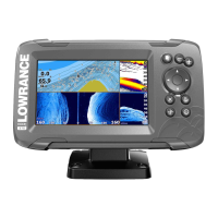
GPS plotter page
Zoom the image by using the Zoom keys
Pan the image in any direction by using the Arrow keys
Display item information by positioning the cursor on an item
then selecting the Info option in the menu
1
2
3
6
4
5
1 Data overlay (Can be edited, moved or removed. Refer to
"Data Overlay" on page 12).
2 Waypoint*
3 Vessel with trail (displaying the trail is optional*)
4 Route*
5 North indicator
6 Range scale
3
GPS plotter | Hook² X Series Operator Manual

Other manuals for Lowrance HOOK2-4x

Questions and Answers:

Question and Answer IconNeed help?

Do you have a question about the Lowrance HOOK2-4x and is the answer not in the manual?

Lowrance HOOK2-4x Specifications

General IconGeneral
Display Size4.3 inches
Display Resolution480 x 272 pixels
Display TypeColor TFT
Sonar Frequency200 kHz
Power Output200W RMS
GPSNo
Waterproof RatingIPX7
Sonar TypeBroadband
TransducerBullet Skimmer
Mounting TypeBracket
Maximum Depth500 ft (152 m)

Related product manuals