Waypoints, Routes, and Trails
Ú
Note: Waypoints, routes, and trails are not available on 4x Sonar
only models.
Waypoints, routes, and trails are available on the GPS plotter page.
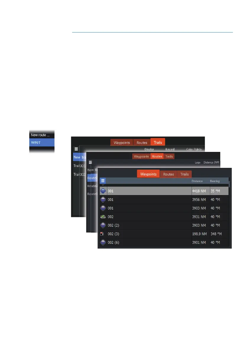
Waypoints, Routes, and Trails dialogs
The Waypoints, Routes, and Trails dialogs give access to advanced
edit functions and settings for these items.
The dialogs are accessed from the W/R/T option on the panel menu.
They can also be accessed from the Waypoints, Routes and Trails
option on the GPS plotter settings dialog, refer to "GPS plotter settings"
on page 16.
Select the menu icon on the dialog to access additional options.
4
Waypoints, Routes, and Trails | Hook² X Series Operator
Manual