North up
Displays the GPS plotter image with north upward.
Course up
The GPS plotter image direction is depending on if navigating or
not:
• when navigating: the desired course is oriented up
• if not navigating: the direction the vessel is actually traveling
(COG) is oriented up
Look ahead
Moves the vessel icon on the panel to maximize your view ahead of
the vessel.
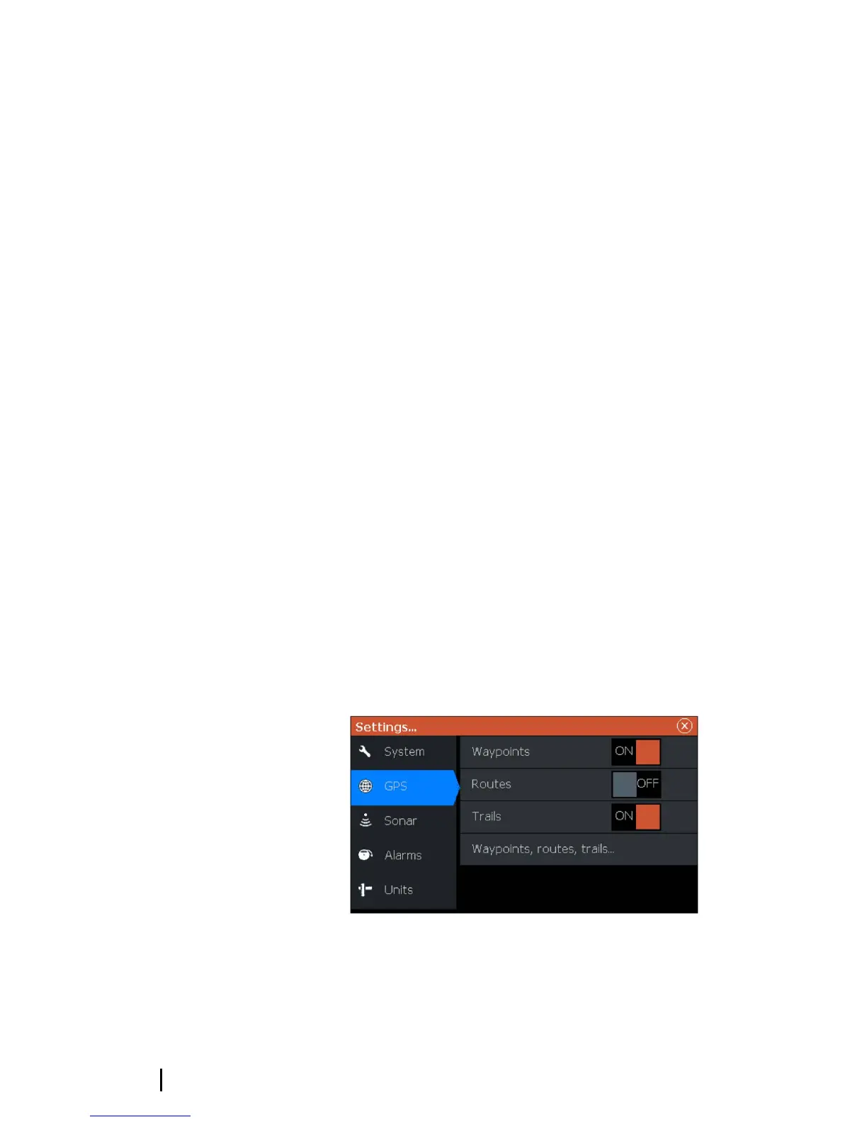
Waypoints, Routes, and Trails
You can position and manage waypoints, routes and trails on the
page. For more information, refer to "Waypoints, Routes, and Trails" on
page 18.
Navigating
You can use the page for navigating to the cursor, to a waypoint, or
navigate a route. Refer to "Navigating" on page 22.
GPS plotter settings
16
GPS plotter | Hook² X Series Operator Manual
 Loading...