Section 4 - Custom Border Configuration (GeoFence)
90-8M0072763 eng JUNE 2012 Page 33
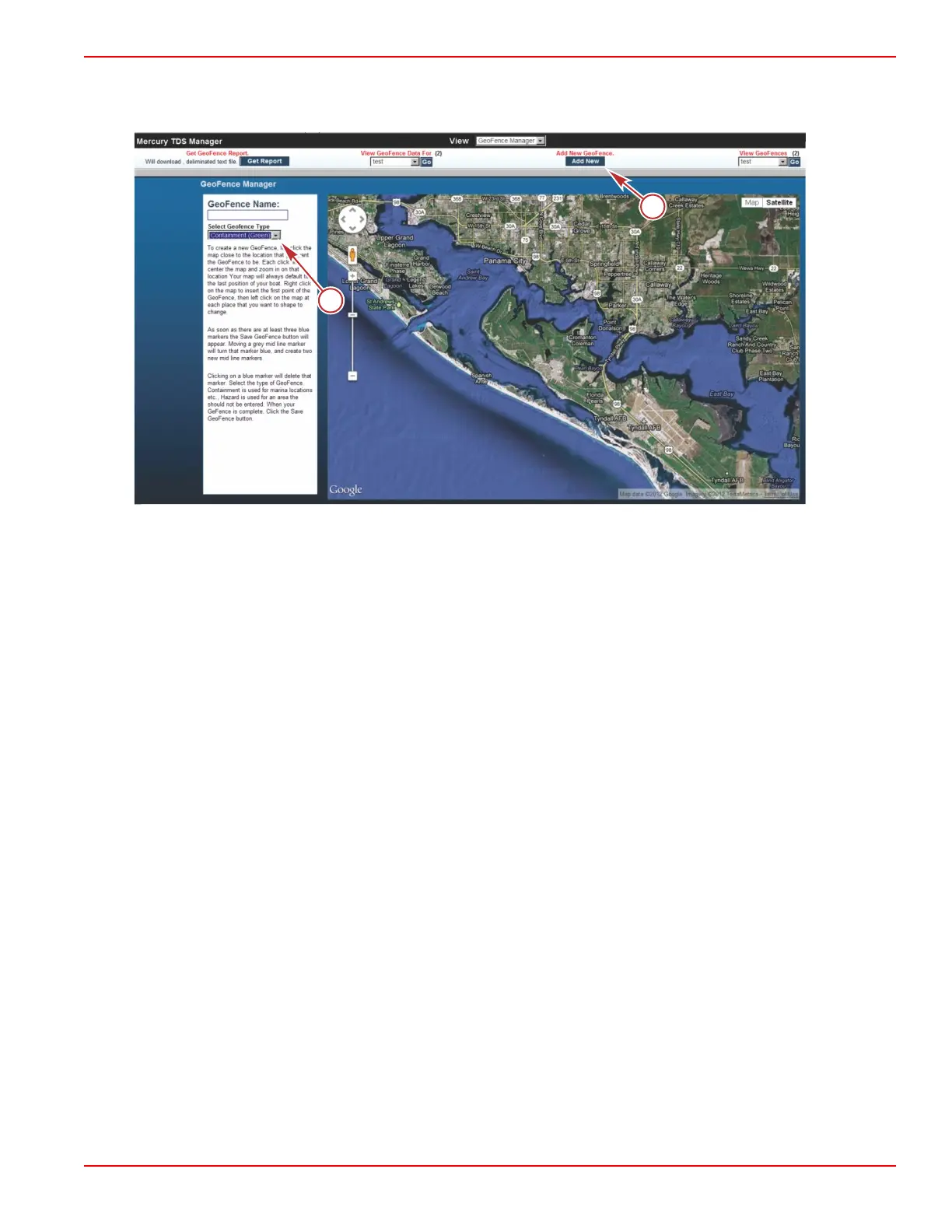
Creating a Fence
1. Click on Add New GeoFence.
a - GeoFence name and type
b - Add New GeoFence
2. A column will open to the left of the map.
3. Enter a name for the fence. Select the type of fence you will create: Containment or Hazard.
• A containment fence is a virtual boundary the vessel is authorized to be operating within. When the containment
fence is crossed over, the system will record when the vessel has left the containment boundary or is entering the
boundary. This recorded information is archived on a server and can be viewed on the website. This boundary can
also be used to identify unauthorized use.
• The hazard fence is a red virtual boundary. The hazard fence can be used to identify areas the vessel should avoid.
4. Left click on the map near to the location you want a virtual fence. Each left click will center and zoom in on that location.
5. Right click to insert the first fence waypoint, then left click to set the next and following fence waypoints. When three blue
waypoints appear, the Save GeoFence icon will appear.
• Moving a grey midline waypoint will turn that waypoint blue and create two new midline waypoints.
 Loading...