51
Systems
Typical Chartplotter
If installed, the unit features a touchscreen, NMEA 2000
compatible, multifunction display, pre-loaded with U. S.
coastal maps and interfaces with other electronic com-
ponents It displays graphics with crisp, video-quality
resolution.
Chartplotter Operation
Before operating the chartplotter read and understand
the vendor supplied owner’s manual including all the
warning information.
ese chartplotters feature “touch” screens. When you
see information groups on the screen use your nger
to touch the format desired. With some information in
particular it is required that you actually drag an object
by using your nger and keeping it on the screen as you
move the object.
A. To power the system up make sure the battery switch
at the battery panel board is energized.
B. Press and release the chartplotter power key. When
the warning screen appears, touch I agree. At this point
you will be taken to the home page screen.
Note that the Garmin system is protected by a 15 amp
fuse usually located at the helm fuse block accessible by
li ing the starboard bow backrest.
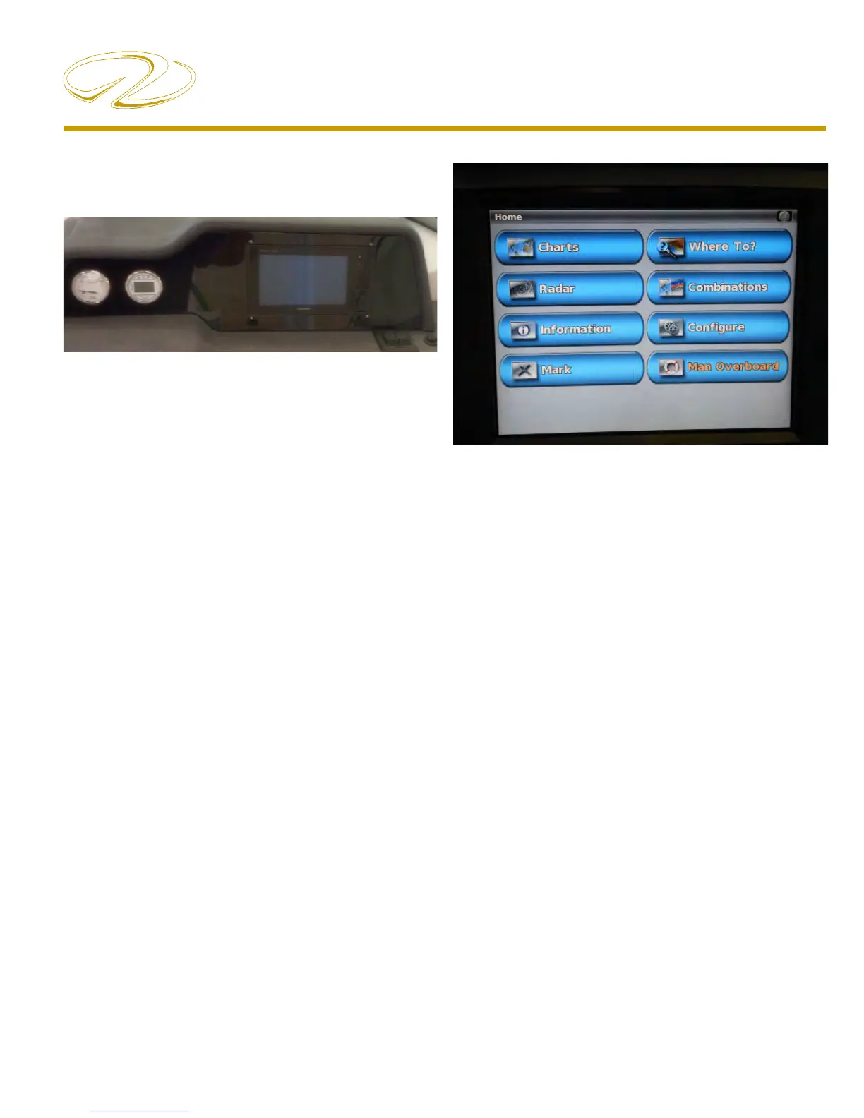
Home Screen
Charts- Selects navigational charts and radar overlay
functions.
Radar- Sets up and provides sonar information through
the optional transducer.
Information- Shows tide conditions, currents, celestial
data, information about other vessels, your yacht’s in-
strumentation, and video.
Mark- Marks, edits, or deletes your current location as a
waypoint or Man Overboard
WhereTo?- Searches and navigates to service areas,
routes and way points.
Combinations- formats screen to view a chart, sonar,
radar, and video cameras if installed.
Con gure- Permits the editing of chartplotter system
settings (Can set a simulator mode where you can prac-
tice using most of the chartplotter functions).
Man Overboard- Marks your current position as a way
point, and sets a course back to the marked location.
 Loading...