ST144-21 C/Ku-Band TVRO Maintenance and Troubleshooting
13-21
PCU Error Status (Word 3)
Sensor Limit **Not a valid state**
Stability Limit Indicates that the above decks equipment is mis-pointed from its intended
target by more than 0.5°. (FCC Tx Mute Compliance)
AZ Reference Error Indicates a failure to integrate one the reference inputs within the Azimuth
Stabilization Loop.
AZ Servo Limit Indicates the current draw through the Azimuth Servo Amplifier (motor driver
PCB) has exceeded what is required during normal operation
LV Servo Limit Indicates the current draw through the Elevation Servo Amplifier (motor driver
PCB) has exceeded what is required during normal operation
CL Servo Limit Indicates the current draw through the Cross-Level Servo Amplifier (motor driver
PCB) has exceeded what is required during normal operation
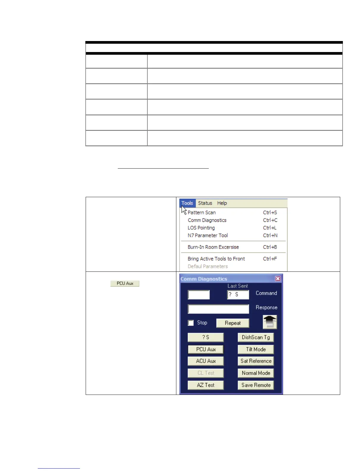
13.7.12.
The above decks equipment has an integrated on board Furuno GPS antenna system. The Latitude and
Longitude position information provided are utilized to calculate the Azimuth, Elevation, Cross-level and
Polarity pointing angles of the desired satellite. The DacRemP “Comm Diagnostics” Window provides a
means to query the GPS antenna to verify proper operation. The procedure below describes this process.
Remote GPS LAT/LON Position:
1. Select the “Comm
Diagnostics” window
under to the Tools
submenu or Press “CTRL +
C”
2. Left mouse click on the
icon.