Advanced functionalities
Note: The ground sensor height indicates the height above the
ground detected by the ground sensor. The sensor can typically de-
tect distances below 60 m, depending on available light and surface
contrast.
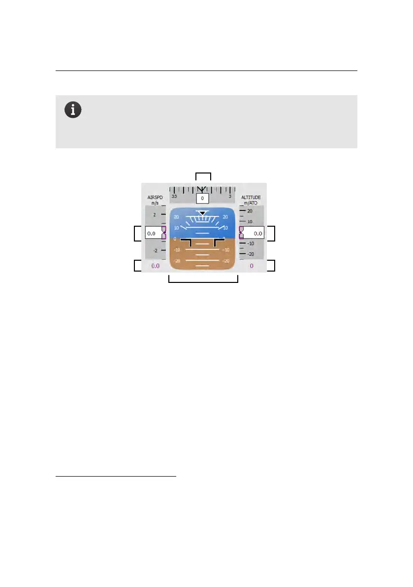
current altitude over
take-off location
current heading in degrees
attitude with respect
to artificial horizon
desired altitude over
take-off location
current air speed
desired air speed
• Instruments: This display mimics the classical primary flight display used
in manned aircraft. The column on the left displays the current air speed
of the eBee RTK as well as the desired air speed, in metres per second. The
column on the right displays the drone’s current altitude over take-off lo-
cation, as well as the desired altitude over the take-off location, in metres.
The bar at the top displays the current heading of the drone³⁶. North is
indicated as 0
◦
, East as 90
◦
, South as 180
◦
and West as 270
◦
.
• Identification: This displays the serial number of your eBee RTK and the
number of the Drone Flight log for the current flight. This number can be
used as a reference when importing flight data after a flight³⁷.
• Payload information: Thissection displays the payload currently selected
and the number of photos that has been taken since take-off³⁸.
³⁶ this feature is only accurate when in flight
³⁷ see section ‘Importing images and flight data’ on page 61
³⁸ see section ‘Camera tab’ on page 131 for instructions on changing the payload type
114