Results of Geotagging
As a result, you can find folders named after your Flight Plans in the "WingtraPilotProjects" folder. It contains the following objects:
/DATA subfolder: All GNSS data available for this particular project.
/IMAGES subfolder: All unmodified images for this particular project.
/OUTPUT subfolder: All output data from the geotagging process.
/DATA/date_time.json file: A text file containing time, GNSS coordinates and attitudes for all images (for non-PPK geotagging).
/DATA/date_time.sbf file: A binary file containing the GNSS information of the mission for PPK geotagging purpose.
/OUTPUT/imagename.jpg files: Tagged images with GNSS coordinates embedded as EXIF tags.
/OUTPUT/projectname.csv file: A geotags text file, which contains all the GNSS coordinates for all images, attitudes for all images (only for non-PPK geotags), and
accuracy of the geotags (only for PPK geotags).
/OUTPUT/geotagging.pdf file: A report which contains all the information regarding the geotagging process.
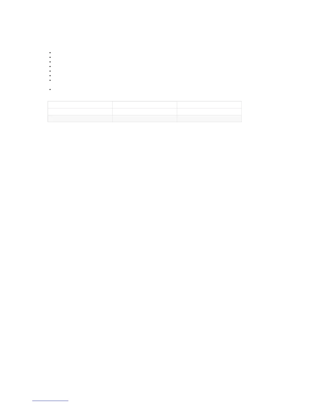
The coordinate system of the output GNSS coordinates from the geotagging process are as shown in the table below:
Version Coordinate System Height Reference System
PPK WGS84 Ellipsoidal height
Non-PPK WGS84 Above mean sea level height (egm96)
To learn more about how to use these output data from the geotagging process, please refer to the image post-processing chapter.