COMPASS STEP 2. Calibration of the
magnetic field sensor input to the
navigation computer.
This procedure is only possible after
STEP 1 has been completed. Step 2 is
carried out in one of three different
methods;
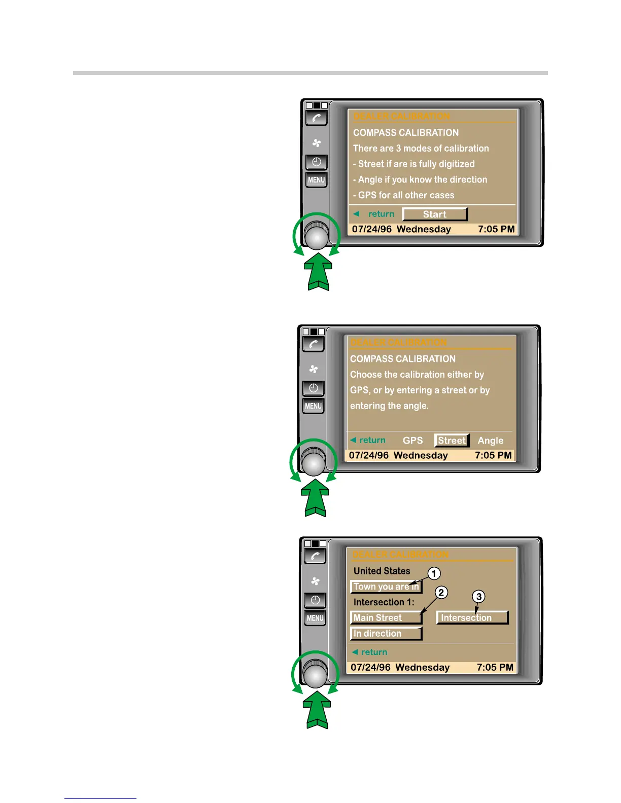
Calibration using a digitized
address.
Calibration using the GPS satellite
signals.
Angular calibration using the
direction of a long section of road.
Preferred Method - DIGITIZED
ADDRESS
This procedure can only be used
within a fully digitized CD map
area.
The actual location is entered into the
on-board monitor and the navigation
system will display a route between
two road intersections, along which the
vehicle must be driven.
1. If the town is not already displayed,
enter it in the same method as
entering a destination.
2. Enter the street at which you want
to start the calibration.
3. Press the intersection button.
46
On-Board Monitor and Navigation Systems
 Loading...