47NX501E/NZ501E
English
English
Owner’s Manual
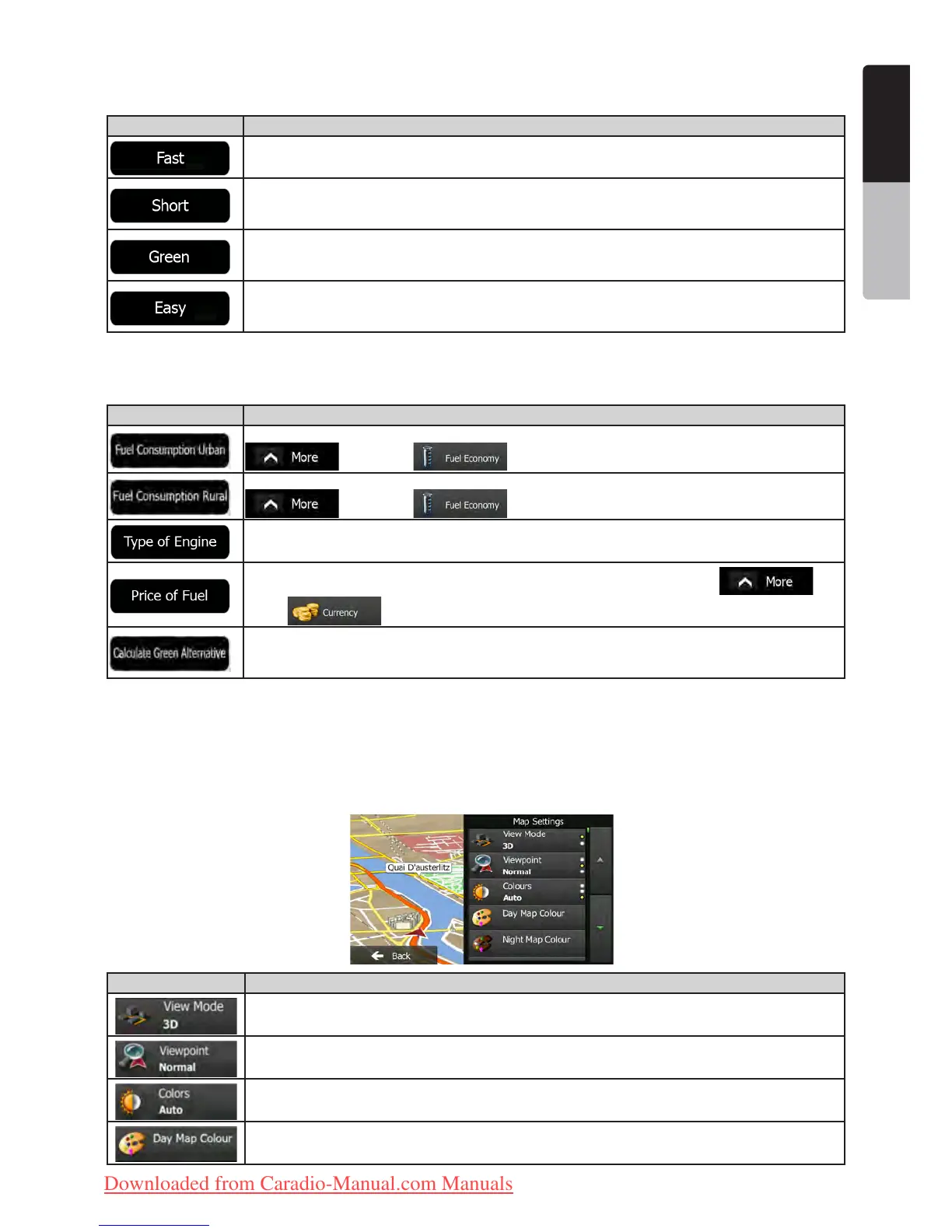
Route Planning Method types:
Button Description
Gives a quick route if you can travel at or near the speed limit on all roads. Usually the best
selection for fast and normal cars.
Gives a short route to minimise the distance to travel. It can be practical for slow vehicles.
Searching for a short route regardless of the speed, this route type is rarely practical for
normal vehicles.
Gives a quick but fuel efficient route based on the fuel consumption data given in Green
Routing settings (page 47). Travel cost and CO
2
emission calculations are estimations only.
They cannot take elevations, curves and traffic conditions into account.
Results in a route with fewer turns and no difficult manoeuvres. With this option, you can
make Clarion Mobile Map to take, for example, the motorway instead of a series of smaller
roads or streets.
4.3.5 Green routing settings
These settings determine how Green routes will be calculated. They are also used to display the cost and CO
2
emission of routes.
Button Description
Enter the average consumption of your vehicle when used in built-up areas. If necessary, tap
and select to change the measurement unit.
Enter the average consumption of your vehicle when used on highways. If necessary, tap
and select to change the measurement unit.
Select the engine and fuel type of your vehicle. This helps in estimating the CO
2
emission.
Enter the average fuel price for travel cost calculation. If necessary, tap and
select to change the currency.
If the selected routing method is not Green, you can have your route compared to the best
green alternative on the screen when confirming the route. If this alternative is much better
than the selected method, you can quickly switch to Green mode.
4.3.6 Map settings
You can fine-tune the appearance of the Map screen. Adjust the map view to your needs, choose suitable colour
themes from the list for both daytime and night use, change the red arrow to a 3D car model, show or hide 3D
buildings, turn track logging on or off, and manage you Place visibility sets (which Places to show on the map).
The map is always shown on the screen so that you can see the effect when you change a setting.
Button Description
Switch the map view between a 3D perspective view and a 2D top-down view.
Adjust the basic zoom and tilt levels to your needs. Three levels are available.
Switch between daytime and night colour modes or let the software switch between the two
modes automatically a few minutes before sunrise and a few minutes after sunset.
Select the colour scheme used in daytime mode.
Clarion_primo_1_1_EU_UserManual_EN-UK.indd 47 2011-2-23 11:24:20
Downloaded from Caradio-Manual.com Manuals

 Loading...