30
©
2022 DJI All Rights Reserved.
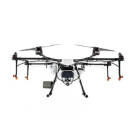
AGRAS T30
Unmanned Aircraft Flight Manual
With a strong GNSS signal
Flight Limits
Max Height Flight altitude must be below the preset height.
Max Radius Flight distance must be within the max radius.
With a weak GNSS signal
Flight Limits
Max Height Flight altitude must be below the preset height.
Max Radius No limit.
If the aircraft ies into a Restricted Zone, it can still be controlled, but the aircraft can only y in
a backward direction.
If the aircraft loses GNSS signal and ies out of the max radius but regains GNSS signal later,
it will y back within range automatically.
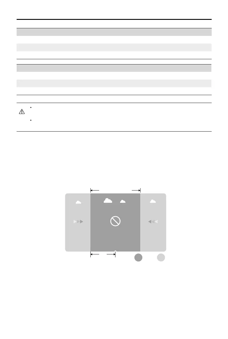
GEO Zones
GEO zones are divided into different categories. All GEO zones are listed on the DJI ofcial website at
http://www.dji.com/ysafe.
GEO zones are explained below (GNSS required):
Depending on the local regulation, a certain radius around a marker forms a Restricted Zone, inside of
which takeoff and ight are prohibited.
Restricted Zone Free Zone
R

 Loading...