DJI Mavic 3E/3T User Manual
66
©
2022 DJI All Rights Reserved.
c. The pointer on the blue dot can be used to indicate the direction the remote
controller is facing when the compass of the remote controller is functioning
properly. During the flight and when the signal is weak, the user can adjust the
position of the remote controller and make the pointer of the blue dot face the
direction of the aircraft to improve signal transmission.
9. PinPoint Information: displays the name of the PinPoint and the horizontal distance
between the aircraft and the PinPoint when PinPoint is enabled.
10. Gimbal Tilt.
11. Aircraft Horizontal Speed.
12. Wind Speed and Direction. The wind direction is relative to the aircraft.
13. Waypoint Information: displays the name of the waypoint and the horizontal
distance between the aircraft and the waypoint and indicates the ascending or
descending trend of the immediate flight route during a flight task.
14. Vertical Obstacle Indicator: once an obstacle is detected in the vertical direction,
an obstacle bar icon will appear. When the aircraft reaches the warning distance,
the icon will glow red and orange, and the remote controller will emit long beeping
sounds. When the aircraft reaches the obstacle braking distance, the icon will glow
red, and the remote controller will emit short beeping sounds. Both the obstacle
braking distance and the warning distance can be set in DJI Pilot 2. Follow the
prompted instructions in the app to set them. The white line shows the position of
the aircraft in three seconds. The higher the vertical speed, the longer the white line.
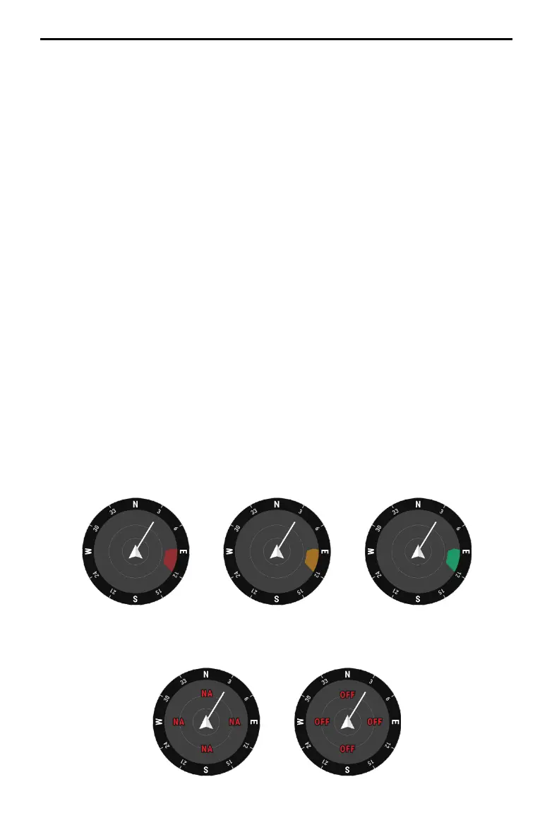
Horizontal Obstacle Sensing Information:
a. If the obstacle is within 16 m but has not reached the warning distance, the obstacle
will be indicated by a green frame; when the obstacle is within 16 m and reaches the
warning distance, the frame turns orange; and when the obstacle approaches the
obstacle breaking distance, the frame turns red.
b. When the obstacle sensing is disabled, OFF will be displayed. When the obstacle
sensing is enabled, but the vision systems and the infrared sensing system are not
available, NA will be displayed.