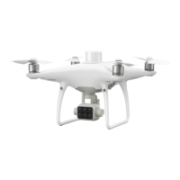
P4 Multispectral User Manual
©
2019 DJI All Rights Reserved.
19
In , set the capture mode, bands to be stored, and NDVI colormap.
Capture mode: Select between single shot and timed shot.
Bands to be stored:
Choose which spectral band photos to save according to the application.
When conguring visible imaging settings, users can select RGB, BLUE, GREEN, RED, RE, and NIR.
When conguring multispectral imaging settings, users can select NDVI, BLUE, GREEN, RED,
RE, and NIR.
Only the photos of the selected bands will be saved. At least one band should be selected.
NDVI colormap:
Set the rendered display color scale in the live view according to the numerical value of the
vegetation index. (available soon)
Photos Storage
Depending on the bands selected, up to 6 photos will be taken and saved every time. The photo
for each band in the group has its own le name. The naming rule is “DJI_XXXY”. XXX refers to
the number of the photo group. Y, with a value of 0 to 5, corresponds to dierent imaging bands:
Y 0 1 2 3 4 5
Imaging Band RGB or NDVI BLUE GREEN RED RE NIR
Generating Multispectral Maps
Import the image data into DJI GS Pro or DJI Terra to generate multispectral maps. Refer to their
user manuals for details.
RTK Functions
The P4 Multispectral has a built-in DJI Onboard D-RTK, which provides more accurate data for
centimeter-level positioning to improve operation precision when using with the DJI D-RTK 2 High
Precision GNSS Mobile Station or Network RTK service. The onboard D-RTK, providing precision
position and speed information combined with optimized algorithms, is more accurate than a
standard compass sensor and functions even with magnetic interference from metal structures,
ensuring stable ight. If the RTK signal is weak and dierential data cannot be transmitted during
a mission, users can read the raw satellite observations* recorded in the microSD card in the
aircraft after the ight, and then use PPK technology to achieve centimeter-level positioning.
* Supported later.