P4 Multispectral User Manual
20
©
2019 DJI All Rights Reserved.
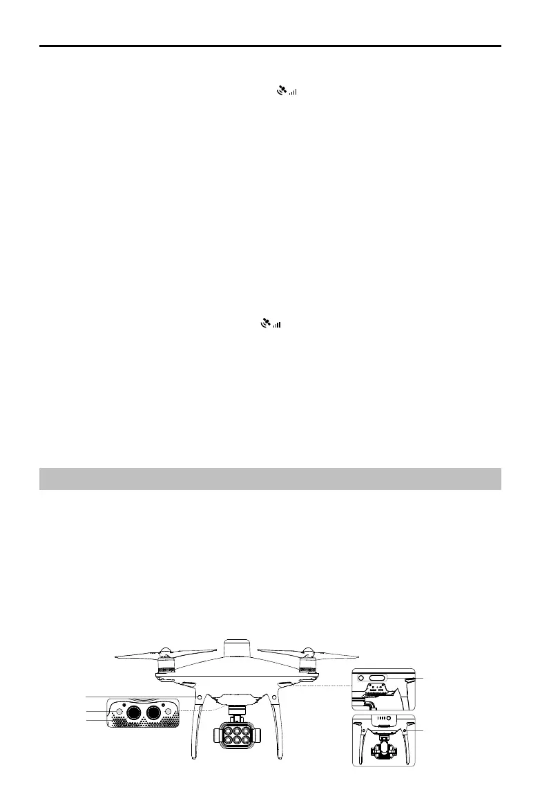
Vision System and Infrared Sensing System
The main components of the Vision System are located on the front, rear and bottom of the
aircraft, including [1] [2] [4] three stereo vision sensors and [3] two ultrasonic sensors. The Vision
System uses ultrasound and image data to help the aircraft maintain its current position, enabling
precision hovering indoors or in environments where a GNSS signal is not available. The Vision
System constantly scans for obstacles, allowing the aircraft to avoid them by going over, around,
or hovering.
The Infrared Sensing System consists [5] of two 3D infrared modules on both sides of the aircraft.
These scan for obstacles on both sides of the aircraft and is active in certain ight modes.
Using with the DJI D-RTK 2 Mobile Station
1. Go to Mission Page in DJI GS Pro, tap the icon or RTK on top of the screen to go
to the RTK settings menu, and then select D-RTK 2 as the RTK data source. Enable the
aircraft RTK at the bottom of the menu to ensure the aircraft has access to RTK data.
2. Tap Link. The remote controller will start beeping. Then press the link button on the mobile station.
3. Tap Connect to establish connection with the server. Wait for the RTK icon to display FIX, indicating
that the dierential data calculation is completed and the aircraft can use RTK for positioning.
Using with Network RTK Service
The Network RTK service uses the remote controller instead of the base station to connect to an
approved Network RTK server to send and receive dierential data. Keep the remote controller
on and the mobile device connected to the internet when using this function.
1. Ensure that the remote controller is connected to the aircraft and the mobile device has
access to the Internet.
2. Go to Mission Page in DJI GS Pro, tap the icon or RTK on top of the screen to go to the
RTK settings menu, and then select Network RTK Account as the RTK data source.
3. Tap New in the Network RTK Account setting page. After configuration, go back to the
settings menu to select the added account.
4. Enable the aircraft RTK at the bottom of the menu to ensure the aircraft has access to RTK data.
5. Tap Connect to establish connection with the server. Wait for the RTK icon to display FIX,
indicating that the differential data calculation is completed and the aircraft can use RTK for
positioning.
[1]
[2]
[3]
[4]
[5]