©
2019 DJI All Rights Reserved.
51
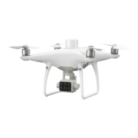
Aircraft
Takeo Weight 1487 g
Diagonal Distance (Propellers Excluded) 350 mm
Max Service Ceiling Above Sea Level 19685 ft (6000 m)
Max Ascent Speed 6 m/s (automatic ight); 5 m/s (manual control)
Max Descent Speed 3 m/s
Max Speed 31 mph (50 kph) (P-mode); 36 mph (58 kph) (A-mode)
Max Flight Time Approx. 27 minutes
Operating Temperature 0° to 40° C (32° to 104° F)
Operating Frequency
2.4000 GHz to 2.4835 GHz (Europe, Japan, Korea)
5.725 GHz to 5.850 GHz (Other countries/regions)
[1]
Transmission Power (EIRP)
2.4 GHz: < 20 dBm (CE / MIC / KCC)
5.8 GHz: < 26 dBm (FCC / SRRC / NCC)
Hover Accuracy Range
RTK enabled and functioning properly:
Vertical: ±0.1 m; Horizontal: ±0.1 m
RTK disabled:
Vertical: ±0.1 m (with vision positioning); ±0.5 m (with
GNSS positioning)
Horizontal: ±0.3 m (with vision positioning); ±1.5 m (with
GNSS positioning)
Image Position Compensation
The relative positions of the centers of the six cameras’
CMOS and the phase center of the onboard D-RTK
antenna have been calibrated and are recorded in the
EXIF data of each image.
GNSS
Single-Frequency High-Sensitivity
GNSS
GPS + BeiDou + Galileo
[2]
(Asia); GPS + GLONASS +
Galileo
[2]
(other regions)
Multi-Frequency Multi-System High-
Precision RTK GNSS
Frequency Used
GPS: L1/L2; GLONASS: L1/L2; BeiDou: B1/B2; Galileo
[2]
:
E1/E5
First-Fixed Time: < 50 s
Positioning Accuracy: Vertical 1.5 cm + 1 ppm (RMS);
Horizontal 1 cm + 1 ppm (RMS).
1 ppm indicates error with a 1 mm increase over 1 km of
movement.
Velocity Accuracy: 0.03 m/s
Mapping Functions
Ground Sample Distance (GSD)
(H/18.9) cm/pixel, H indicates the aircraft altitude relative
to the area mapped (unit: m)
Rate of Data Collection
Max operating area of approx. 0.47 km
2
for a single ight
at an altitude of 180 m, i.e., GSD is approx. 9.52 cm/pixel
Appendix
Specifications